Sheboygan Falls night lights from space
Night Light of Sheboygan Falls (Wisconsin) from space (United States) Src. Average luminocity for 10x10km area is 27.9712% and for 50x50km: 6.4093%.
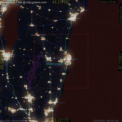
Analysis of Sheboygan Falls night lights 2016
Square area 10x10 km:
 2.27%
2.27%90-99
2.27%80-89
5.91%70-79
2.42%60-69
5.15%50-59
3.18%40-49
5.76%30-39
3.64%20-29
13.94%10-19
21.06%0-9
34.39%Square area 50x50 km:
0.65%90-99
0.66%80-89
1.48%70-79
0.6%60-69
0.87%50-59
0.53%40-49
1.01%30-39
0.71%20-29
1.73%10-19
4.2%0-9
87.57%Clear (daylight) street map image can be seen on geolist.org.
Map coordinates:
44° 14' 16.4" North, 88° 31' 30.9" West
43° 43' 55.1" North, 87° 49' 19.7" West
43° 13' 18.3" North, 87° 7' 8.4" West
Some cities around Sheboygan Falls sort by population:
• Fond du Lac
49.8 km =30.9 mi,  275°
275°
• Manitowoc
41.8 km =26 mi,  18°
18°
• West Bend
44.8 km =27.8 mi,  220°
220°
• Port Washington
38.6 km =24 mi,  186°
186°
• Grafton
47 km =29.2 mi, 193°
• Cedarburg
50.2 km =31.2 mi,  195°
195°
• Two Rivers
51.1 km =31.8 mi, 23°
• Plymouth
12.6 km =7.8 mi, 278°
5272907 (p: 7,840)
Sources (retrieved 2019-11-25):
» Earth at Night: Flat Maps 2012, 2016