Cedarburg night lights from space
Night Light of Cedarburg (Wisconsin) from space (United States) Src. Average luminocity for 10x10km area is 37.5833% and for 50x50km: 24.5706%.
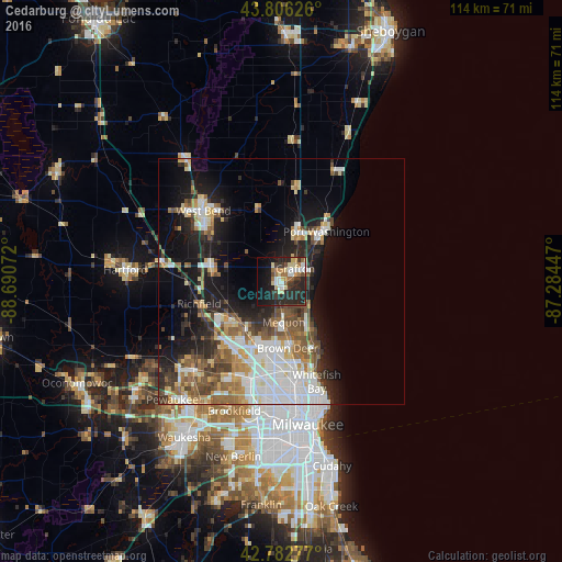
Analysis of Cedarburg night lights 2016
Square area 10x10 km:
 4.09%
4.09%90-99
5.76%80-89
7.88%70-79
2.58%60-69
5.91%50-59
2.88%40-49
3.33%30-39
9.09%20-29
23.18%10-19
20.91%0-9
14.39%Square area 50x50 km:
5.59%90-99
4.54%80-89
2.8%70-79
2.46%60-69
2.92%50-59
3.64%40-49
3.45%30-39
2.7%20-29
5.89%10-19
12.18%0-9
53.82%Clear (daylight) street map image can be seen on geolist.org.
Map coordinates:
43° 48' 22.5" North, 88° 41' 26.6" West
43° 17' 48" North, 87° 59' 15.3" West
42° 46' 58" North, 87° 17' 4.1" West
Some cities around Cedarburg sort by population:
• Menomonee Falls
16.8 km =10.4 mi,  218°
218°
• Mequon
9.7 km =6 mi,  200°
200°
• Germantown
12.5 km =7.8 mi,  232°
232°
• Brown Deer
14.9 km =9.3 mi,  172°
172°
• Port Washington
13.5 km =8.4 mi,  41°
41°
• Grafton
3.8 km =2.4 mi,  47°
47°
• Jackson
14.8 km =9.2 mi,  281°
281°
• Fox Point
17 km =10.6 mi,  155°
155°
5248171 (p: 11,482)
Sources (retrieved 2019-11-25):
» Earth at Night: Flat Maps 2012, 2016