Plymouth night lights from space
Night Light of Plymouth (Wisconsin) from space (United States) Src. Average luminocity for 10x10km area is 20.4% and for 50x50km: 6.8131%.
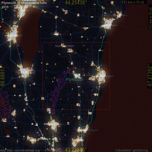
Analysis of Plymouth night lights 2016
Square area 10x10 km:
 3.64%
3.64%90-99
3.33%80-89
2.73%70-79
0.91%60-69
3.48%50-59
1.82%40-49
1.67%30-39
1.52%20-29
1.97%10-19
21.52%0-9
57.42%Square area 50x50 km:
0.66%90-99
0.72%80-89
1.59%70-79
0.65%60-69
0.93%50-59
0.65%40-49
1.01%30-39
0.73%20-29
1.81%10-19
4.2%0-9
87.04%Clear (daylight) street map image can be seen on geolist.org.
Map coordinates:
44° 15' 15.8" North, 88° 40' 48.6" West
43° 44' 55" North, 87° 58' 37.3" West
43° 14' 18.7" North, 87° 16' 26.1" West
Some cities around Plymouth sort by population:
• Sheboygan
21.1 km =13.1 mi,  89°
89°
• Fond du Lac
37.2 km =23.1 mi,  274°
274°
• Manitowoc
45.6 km =28.3 mi,  34°
34°
• West Bend
39.6 km =24.6 mi,  204°
204°
• Port Washington
41 km =25.5 mi,  168°
168°
• Grafton
47.7 km =29.6 mi,  177°
177°
• Sheboygan Falls
12.6 km =7.8 mi,  98°
98°
• North Fond du Lac
41.2 km =25.6 mi,  279°
279°
5267585 (p: 8,505)
Sources (retrieved 2019-11-25):
» Earth at Night: Flat Maps 2012, 2016