Manitowoc night lights from space
Night Light of Manitowoc (Wisconsin) from space (United States) Src. Average luminocity for 10x10km area is 47.0091% and for 50x50km: 4.1475%.
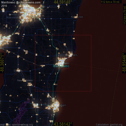

Analysis of Manitowoc night lights 2016
Square area 10x10 km:
 11.82%
90-99
12.88%80-89
7.58%70-79
3.94%60-69
2.58%50-59
2.12%40-49
4.24%30-39
3.33%20-29
15%10-19
24.24%0-9
12.27%Square area 50x50 km:
0.56%90-99
0.64%80-89
0.69%70-79
0.54%60-69
0.28%50-59
0.42%40-49
0.52%30-39
0.37%20-29
1.25%10-19
3.36%0-9
91.37%Clear (daylight) street map image can be seen on geolist.org.
Map coordinates:
44° 35' 29.3" North, 88° 21' 38.6" West
44° 5' 19" North, 87° 39' 27.3" West
43° 34' 53.1" North, 86° 57' 16.1" West
Some cities around Manitowoc sort by population:
• Sheboygan
37.8 km =23.5 mi,  186°
186°
• De Pere
51.3 km =31.9 mi,  321°
321°
• Kaukauna
53.3 km =33.1 mi,  293°
293°
• Bellevue
44.7 km =27.8 mi,  332°
332°
• Allouez
51.8 km =32.2 mi, 326°
• Two Rivers
10.1 km =6.3 mi,  44°
44°
• Plymouth
45.6 km =28.3 mi,  214°
214°
• Sheboygan Falls
41.8 km =26 mi,  198°
198°
5261585 (p: 33,010)
Sources (retrieved 2019-11-25):
» Earth at Night: Flat Maps 2012, 2016