Santa Fe Springs night lights from space
Night Light of Santa Fe Springs (California) from space (United States) Src. Average luminocity for 10x10km area is 99.1329% and for 50x50km: 92.6699%.
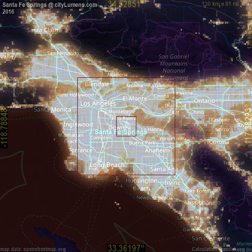
Analysis of Santa Fe Springs night lights 2016
Square area 10x10 km:
 65.03%
90-99
34.09%80-89
0.52%70-79
0.35%60-69
0%50-59
0%40-49
0%30-39
0%20-29
0%10-19
0%0-9
0%Square area 50x50 km:
51.4%90-99
25.47%80-89
6.97%70-79
7.71%60-69
4.62%50-59
2.16%40-49
0.87%30-39
0.43%20-29
0.36%10-19
0.03%0-9
0%Clear (daylight) street map image can be seen on geolist.org.
Map coordinates:
34° 31' 42.6" North, 118° 47' 18.5" West
33° 56' 50.1" North, 118° 5' 7.3" West
33° 21' 43.1" North, 117° 22' 56" West
Some cities around Santa Fe Springs sort by population:
• Downey
4.4 km =2.7 mi,  259°
259°
• Norwalk
5 km =3.1 mi,  176°
176°
• Whittier
6 km =3.7 mi,  53°
53°
• Pico Rivera
4.1 km =2.5 mi,  345°
345°
• Montebello
7.2 km =4.5 mi, 345°
• South Whittier
4.3 km =2.7 mi,  85°
85°
• Bell Gardens
6.4 km =4 mi,  288°
288°
• West Whittier-Los Nietos
3.5 km =2.2 mi,  25°
25°
5393128 (p: 18,026)
Sources (retrieved 2019-11-25):
» Earth at Night: Flat Maps 2012, 2016