Salisbury night lights from space
Night Light of Salisbury (New York) from space (United States) Src. Average luminocity for 10x10km area is 97.5552% and for 50x50km: 58.4954%.
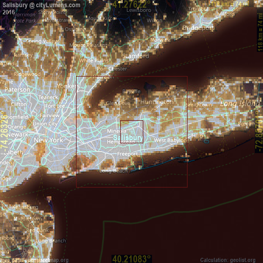
Analysis of Salisbury night lights 2016
Square area 10x10 km:
 58.6%
58.6%90-99
31.98%80-89
4.55%70-79
4.87%60-69
0%50-59
0%40-49
0%30-39
0%20-29
0%10-19
0%0-9
0%Square area 50x50 km:
23.76%90-99
13.35%80-89
5.59%70-79
6.53%60-69
6.23%50-59
4.79%40-49
3.31%30-39
2.99%20-29
5.89%10-19
8.33%0-9
19.22%Clear (daylight) street map image can be seen on geolist.org.
Map coordinates:
41° 16' 34.4" North, 74° 15' 47.7" West
40° 44' 44.4" North, 73° 33' 36.5" West
40° 12' 39" North, 72° 51' 25.2" West
Some cities around Salisbury sort by population:
• Levittown
4.4 km =2.7 mi,  119°
119°
• Hicksville
3.9 km =2.4 mi,  49°
49°
• East Meadow
3.5 km =2.2 mi,  178°
178°
• Uniondale
5.7 km =3.5 mi,  208°
208°
• Westbury
2.6 km =1.6 mi,  295°
295°
• New Cassel
1.7 km =1.1 mi,  331°
331°
• Jericho
5.4 km =3.4 mi,  18°
18°
• East Garden City
3.6 km =2.2 mi,  242°
242°
5136107 (p: 12,093)
Sources (retrieved 2019-11-25):
» Earth at Night: Flat Maps 2012, 2016