Uniondale night lights from space
Night Light of Uniondale (New York) from space (United States) Src. Average luminocity for 10x10km area is 99.5179% and for 50x50km: 57.3619%.
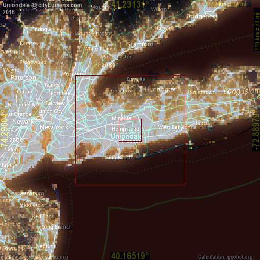
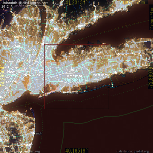
Analysis of Uniondale night lights 2016
Square area 10x10 km:
 79.06%
90-99
19.97%80-89
0.97%70-79
0%60-69
0%50-59
0%40-49
0%30-39
0%20-29
0%10-19
0%0-9
0%Square area 50x50 km:
25.33%90-99
12.63%80-89
4.9%70-79
5.8%60-69
5.83%50-59
4.6%40-49
3.37%30-39
2.92%20-29
5.29%10-19
6.73%0-9
22.59%Clear (daylight) street map image can be seen on geolist.org.
Map coordinates:
41° 13' 52.7" North, 74° 17' 45.7" West
40° 42' 1.4" North, 73° 35' 34.5" West
40° 9' 54.7" North, 72° 53' 23.2" West
Some cities around Uniondale sort by population:
• Hempstead
2.3 km =1.4 mi,  286°
286°
• Freeport
4.8 km =3 mi,  170°
170°
• East Meadow
3.2 km =2 mi,  62°
62°
• Garden City
4.6 km =2.9 mi,  310°
310°
• West Hempstead
4.8 km =3 mi,  275°
275°
• Roosevelt
2.4 km =1.5 mi, 172°
• North Merrick
2.7 km =1.7 mi,  112°
112°
• East Garden City
3.4 km =2.1 mi,  352°
352°
5141927 (p: 24,759)
Sources (retrieved 2019-11-25):
» Earth at Night: Flat Maps 2012, 2016