East Garden City night lights from space
Night Light of East Garden City (New York) from space (United States) Src. Average luminocity for 10x10km area is 98.5617% and for 50x50km: 59.805%.
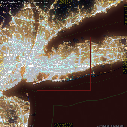
Analysis of East Garden City night lights 2016
Square area 10x10 km:
 67.37%
90-99
26.79%80-89
4.22%70-79
1.62%60-69
0%50-59
0%40-49
0%30-39
0%20-29
0%10-19
0%0-9
0%Square area 50x50 km:
26.32%90-99
13.33%80-89
5%70-79
6.03%60-69
5.93%50-59
4.69%40-49
3.4%30-39
3.01%20-29
5.53%10-19
8.02%0-9
18.73%Clear (daylight) street map image can be seen on geolist.org.
Map coordinates:
41° 15' 41.4" North, 74° 18' 4.3" West
40° 43' 51" North, 73° 35' 53" West
40° 11' 45.2" North, 72° 53' 41.8" West
Some cities around East Garden City sort by population:
• Hempstead
3.2 km =2 mi,  212°
212°
• Uniondale
3.4 km =2.1 mi,  172°
172°
• Garden City
3.1 km =1.9 mi,  261°
261°
• Mineola
4.1 km =2.5 mi,  299°
299°
• Westbury
2.9 km =1.8 mi,  17°
17°
• New Cassel
3.9 km =2.4 mi,  37°
37°
• Salisbury
3.6 km =2.2 mi,  62°
62°
• Williston Park
4.9 km =3 mi,  305°
305°
5115854 (p: 6,208)
Sources (retrieved 2019-11-25):
» Earth at Night: Flat Maps 2012, 2016