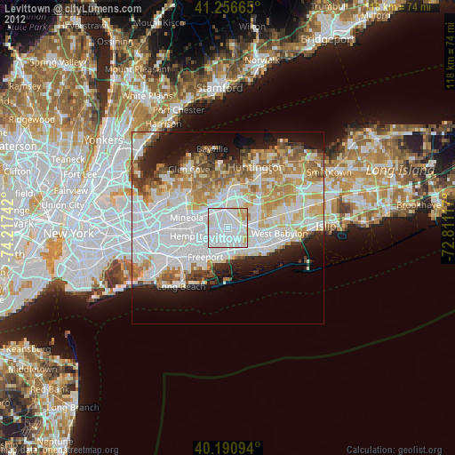
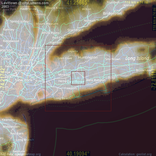
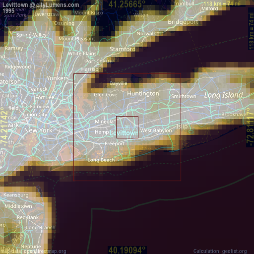
Levittown night lights from space
Night Light of Levittown (New York) from space (United States) Src. Average luminocity for 10x10km area is 97.7825% and for 50x50km: 54.6227%.

Analysis of Levittown night lights 2016
Square area 10x10 km:
 56.82%
90-99
34.74%80-89
7.31%70-79
1.14%60-69
0%50-59
0%40-49
0%30-39
0%20-29
0%10-19
0%0-9
0%Square area 50x50 km:
20.36%90-99
12.66%80-89
5.71%70-79
6.79%60-69
6.11%50-59
4.9%40-49
3.1%30-39
3.01%20-29
6.1%10-19
8.4%0-9
22.88%Clear (daylight) street map image can be seen on geolist.org.
Map coordinates:
41° 15' 23.9" North, 74° 13' 2.7" West
40° 43' 33.3" North, 73° 30' 51.4" West
40° 11' 27.4" North, 72° 48' 40.2" West
Some cities around Levittown sort by population:
• Hicksville
4.8 km =3 mi,  349°
349°
• East Meadow
4 km =2.5 mi,  250°
250°
• North Bellmore
4.2 km =2.6 mi,  202°
202°
• Wantagh
4.7 km =2.9 mi,  175°
175°
• Bethpage
3.4 km =2.1 mi,  53°
53°
• Salisbury
4.4 km =2.7 mi,  299°
299°
• North Wantagh
3.7 km =2.3 mi,  171°
171°
• Plainedge
2.7 km =1.7 mi,  110°
110°
5124276 (p: 51,881)
Sources (retrieved 2019-11-25):
» NASA, Earths city lights 1995
» NASA city lights 2003
» Earth at Night: Flat Maps 2012, 2016