Westbury night lights from space
Night Light of Westbury (New York) from space (United States) Src. Average luminocity for 10x10km area is 94.8036% and for 50x50km: 61.1282%.
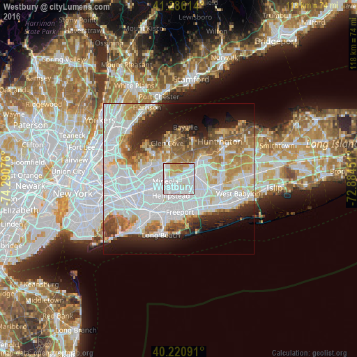
Analysis of Westbury night lights 2016
Square area 10x10 km:
 49.03%
90-99
30.52%80-89
7.47%70-79
11.36%60-69
1.62%50-59
0%40-49
0%30-39
0%20-29
0%10-19
0%0-9
0%Square area 50x50 km:
26.11%90-99
13.74%80-89
5.48%70-79
6.38%60-69
6.32%50-59
4.72%40-49
3.5%30-39
3.08%20-29
5.74%10-19
8.37%0-9
16.56%Clear (daylight) street map image can be seen on geolist.org.
Map coordinates:
41° 17' 10.1" North, 74° 17' 26.7" West
40° 45' 20.4" North, 73° 35' 15.5" West
40° 13' 15.3" North, 72° 53' 4.2" West
Some cities around Westbury sort by population:
• East Meadow
5.2 km =3.2 mi,  152°
152°
• Garden City
5.1 km =3.2 mi,  230°
230°
• Mineola
4.5 km =2.8 mi,  260°
260°
• New Cassel
1.6 km =1 mi,  76°
76°
• Salisbury
2.6 km =1.6 mi,  115°
115°
• Williston Park
4.8 km =3 mi,  271°
271°
• East Garden City
2.9 km =1.8 mi,  197°
197°
• Albertson
5.1 km =3.2 mi,  292°
292°
5144040 (p: 15,379)
Sources (retrieved 2019-11-25):
» Earth at Night: Flat Maps 2012, 2016