Salem night lights from space
Night Light of Salem (Wisconsin) from space (United States) Src. Average luminocity for 10x10km area is 23.2159% and for 50x50km: 33.2481%.
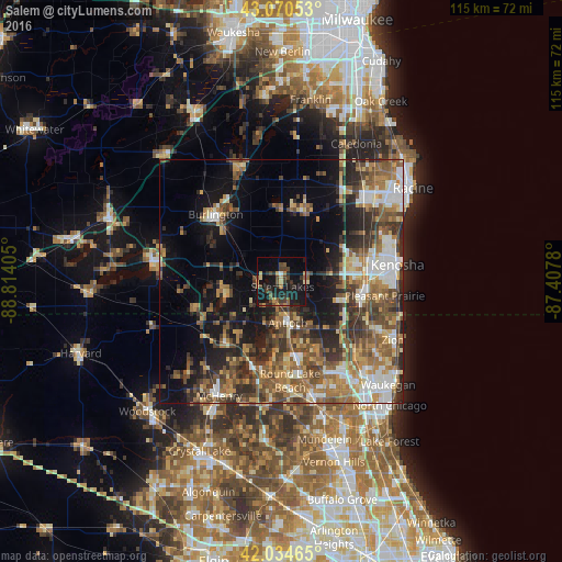
Analysis of Salem night lights 2016
Square area 10x10 km:
 0.32%
0.32%90-99
0.48%80-89
3.02%70-79
3.97%60-69
1.43%50-59
5.4%40-49
6.35%30-39
4.76%20-29
9.52%10-19
33.49%0-9
31.27%Square area 50x50 km:
4.03%90-99
4.73%80-89
3.68%70-79
4.62%60-69
6%50-59
7.4%40-49
6.91%30-39
6.03%20-29
8.35%10-19
12.69%0-9
35.57%Clear (daylight) street map image can be seen on geolist.org.
Map coordinates:
43° 4' 13.9" North, 88° 48' 50.6" West
42° 33' 17.1" North, 88° 6' 39.3" West
42° 2' 4.7" North, 87° 24' 28.1" West
Some cities around Salem sort by population:
• Pleasant Prairie
14.5 km =9 mi,  90°
90°
• Lindenhurst
17.5 km =10.9 mi,  156°
156°
• Antioch
8.7 km =5.4 mi,  171°
171°
• Fox Lake
18.6 km =11.6 mi,  198°
198°
• Somers
19 km =11.8 mi,  59°
59°
• Lake Villa
15.6 km =9.7 mi, 168°
• Twin Lakes
11.5 km =7.1 mi,  256°
256°
• Spring Grove
16.1 km =10 mi,  219°
219°
5271991 (p: 11,416)
Sources (retrieved 2019-11-25):
» Earth at Night: Flat Maps 2012, 2016