Antioch night lights from space
Night Light of Antioch (Illinois) from space (United States) Src. Average luminocity for 10x10km area is 42.6905% and for 50x50km: 38.4558%.
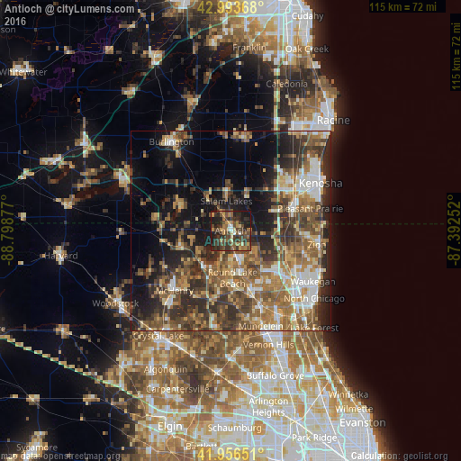
Analysis of Antioch night lights 2016
Square area 10x10 km:
 1.59%
1.59%90-99
2.7%80-89
3.33%70-79
7.78%60-69
8.25%50-59
8.41%40-49
18.1%30-39
16.19%20-29
14.76%10-19
18.73%0-9
0.16%Square area 50x50 km:
4.24%90-99
5.02%80-89
4.3%70-79
5.36%60-69
7.78%50-59
8.71%40-49
8.6%30-39
7.88%20-29
10.81%10-19
13.06%0-9
24.25%Clear (daylight) street map image can be seen on geolist.org.
Map coordinates:
42° 59' 37.2" North, 88° 47' 55.6" West
42° 28' 38.1" North, 88° 5' 44.3" West
41° 57' 23.4" North, 87° 23' 33.1" West
Some cities around Antioch sort by population:
• Round Lake Beach
11.7 km =7.3 mi,  177°
177°
• Lindenhurst
9.3 km =5.8 mi,  142°
142°
• Salem
8.7 km =5.4 mi,  351°
351°
• Fox Lake
11.5 km =7.1 mi,  218°
218°
• Lake Villa
6.9 km =4.3 mi,  165°
165°
• Round Lake Park
13.5 km =8.4 mi, 173°
• Spring Grove
12.1 km =7.5 mi,  252°
252°
• Grandwood Park
12.9 km =8 mi, 136°
4883393 (p: 14,329)
Sources (retrieved 2019-11-25):
» Earth at Night: Flat Maps 2012, 2016