Lake Villa night lights from space
Night Light of Lake Villa (Illinois) from space (United States) Src. Average luminocity for 10x10km area is 58.7841% and for 50x50km: 43.7954%.
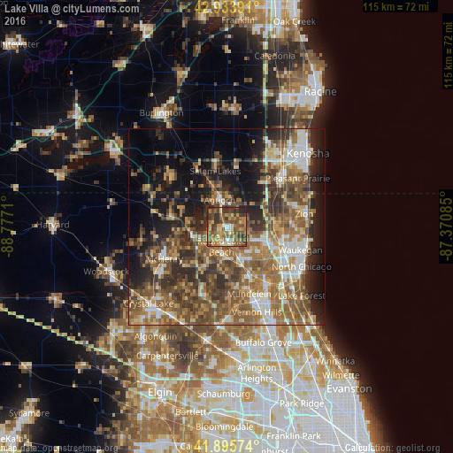
Analysis of Lake Villa night lights 2016
Square area 10x10 km:
 2.86%
2.86%90-99
7.14%80-89
8.25%70-79
13.33%60-69
11.9%50-59
19.84%40-49
15.71%30-39
15.87%20-29
4.92%10-19
0.16%0-9
0%Square area 50x50 km:
5.06%90-99
5.83%80-89
5.11%70-79
6.16%60-69
9.68%50-59
11.18%40-49
9.87%30-39
7.47%20-29
9.62%10-19
12.53%0-9
17.49%Clear (daylight) street map image can be seen on geolist.org.
Map coordinates:
42° 56' 2.1" North, 88° 46' 37.6" West
42° 25' 1.1" North, 88° 4' 26.3" West
41° 53' 44.7" North, 87° 22' 15.1" West
Some cities around Lake Villa sort by population:
• Round Lake Beach
5.2 km =3.2 mi,  194°
194°
• Grayslake
8.5 km =5.3 mi,  161°
161°
• Round Lake
7.3 km =4.5 mi, 192°
• Lindenhurst
4 km =2.5 mi,  100°
100°
• Antioch
6.9 km =4.3 mi,  345°
345°
• Fox Lake
9.3 km =5.8 mi,  255°
255°
• Round Lake Park
6.7 km =4.2 mi,  181°
181°
• Grandwood Park
7.6 km =4.7 mi,  110°
110°
4899154 (p: 8,821)
Sources (retrieved 2019-11-25):
» Earth at Night: Flat Maps 2012, 2016