Roanoke Rapids night lights from space
Night Light of Roanoke Rapids (North Carolina) from space (United States) Src. Average luminocity for 10x10km area is 56.7582% and for 50x50km: 6.0758%.
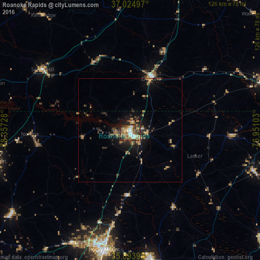
Analysis of Roanoke Rapids night lights 2016
Square area 10x10 km:
 8.61%
8.61%90-99
8.24%80-89
8.97%70-79
12.82%60-69
9.16%50-59
8.79%40-49
6.41%30-39
13.37%20-29
13.37%10-19
9.71%0-9
0.55%Square area 50x50 km:
0.37%90-99
0.34%80-89
0.83%70-79
1.13%60-69
1.01%50-59
0.91%40-49
0.73%30-39
1.71%20-29
2.19%10-19
4.08%0-9
86.7%Clear (daylight) street map image can be seen on geolist.org.
Map coordinates:
37° 1' 29.9" North, 78° 21' 26.2" West
36° 27' 41.5" North, 77° 39' 14.9" West
35° 53' 38.4" North, 76° 57' 3.7" West
Some cities around Roanoke Rapids sort by population:
• Rocky Mount
59.5 km =37 mi,  191°
191°
• Wilson
85.6 km =53.2 mi,  195°
195°
• Henderson
68.3 km =42.4 mi,  257°
257°
• Tarboro
63.7 km =39.6 mi,  170°
170°
• Oxford
85.5 km =53.1 mi, 258°
• Franklin
69.6 km =43.2 mi,  69°
69°
• Emporia
26.9 km =16.7 mi,  21°
21°
• Nashville
60.9 km =37.8 mi,  207°
207°
4488232 (p: 15,345)
Sources (retrieved 2019-11-25):
» Earth at Night: Flat Maps 2012, 2016