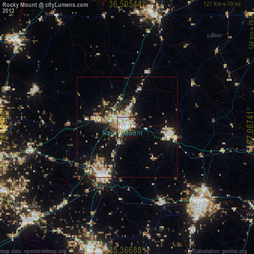
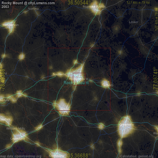
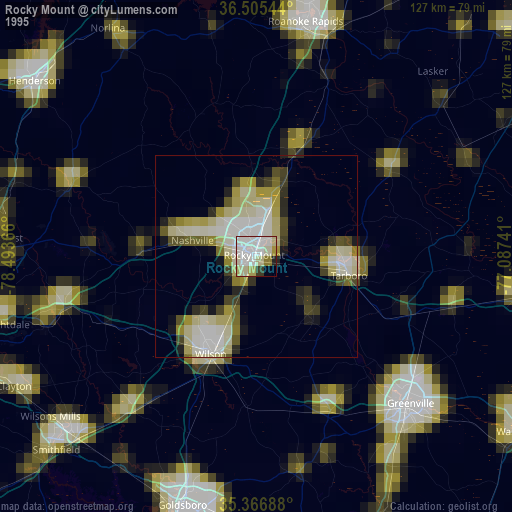
Rocky Mount night lights from space
Night Light of Rocky Mount (North Carolina) from space (United States) Src. Average luminocity for 10x10km area is 68.4249% and for 50x50km: 16.0964%.
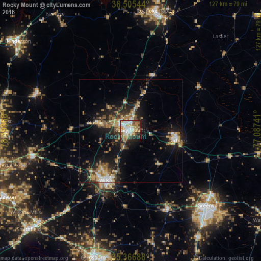
Analysis of Rocky Mount night lights 2016
Square area 10x10 km:
 17.22%
90-99
15.02%80-89
11.9%70-79
9.89%60-69
9.89%50-59
6.96%40-49
9.71%30-39
5.13%20-29
8.42%10-19
5.31%0-9
0.55%Square area 50x50 km:
1.81%90-99
1.69%80-89
2.29%70-79
2.29%60-69
2.91%50-59
1.91%40-49
2.55%30-39
3.61%20-29
4.3%10-19
10.36%0-9
66.28%Clear (daylight) street map image can be seen on geolist.org.
Map coordinates:
36° 30' 19.6" North, 78° 29' 37.2" West
35° 56' 17.6" North, 77° 47' 25.9" West
35° 22' 0.8" North, 77° 5' 14.7" West
Some cities around Rocky Mount sort by population:
• Greenville
52.7 km =32.7 mi,  133°
133°
• Wilson
26.6 km =16.5 mi,  205°
205°
• Roanoke Rapids
59.5 km =37 mi,  11°
11°
• Tarboro
23.4 km =14.5 mi,  101°
101°
• Winterville
57.5 km =35.7 mi,  142°
142°
• Rolesville
60.1 km =37.3 mi,  268°
268°
• Wendell
55 km =34.2 mi,  251°
251°
• Nashville
16.3 km =10.1 mi,  284°
284°
4488762 (p: 55,806)
Sources (retrieved 2019-11-25):
» NASA, Earths city lights 1995
» NASA city lights 2003
» Earth at Night: Flat Maps 2012, 2016