Wilson night lights from space
Night Light of Wilson (North Carolina) from space (United States) Src. Average luminocity for 10x10km area is 71.3129% and for 50x50km: 12.7183%.
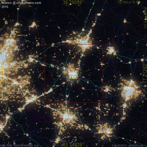
Analysis of Wilson night lights 2016
Square area 10x10 km:
 16.78%
90-99
16.96%80-89
16.08%70-79
10.49%60-69
9.97%50-59
3.67%40-49
7.17%30-39
8.04%20-29
8.39%10-19
2.45%0-9
0%Square area 50x50 km:
1.09%90-99
1.15%80-89
1.76%70-79
1.6%60-69
1.69%50-59
1.46%40-49
2.2%30-39
3.7%20-29
4.09%10-19
8.94%0-9
72.33%Clear (daylight) street map image can be seen on geolist.org.
Map coordinates:
36° 17' 24.2" North, 78° 37' 7.2" West
35° 43' 16.6" North, 77° 54' 55.9" West
35° 8' 54.2" North, 77° 12' 44.7" West
Some cities around Wilson sort by population:
• Rocky Mount
26.6 km =16.5 mi,  25°
25°
• Goldsboro
38 km =23.6 mi,  190°
190°
• Clayton
49.5 km =30.8 mi,  260°
260°
• Smithfield
45 km =28 mi,  238°
238°
• Tarboro
39.4 km =24.5 mi,  60°
60°
• Selma
39.2 km =24.4 mi, 238°
• Wendell
41.5 km =25.8 mi,  279°
279°
• Nashville
28.5 km =17.7 mi,  350°
350°
4499389 (p: 49,643)
Sources (retrieved 2019-11-25):
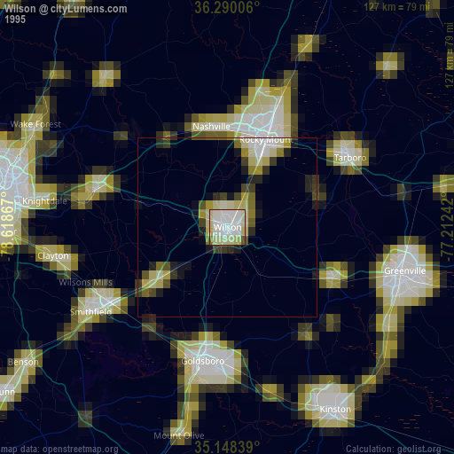
» NASA, Earths city lights 1995
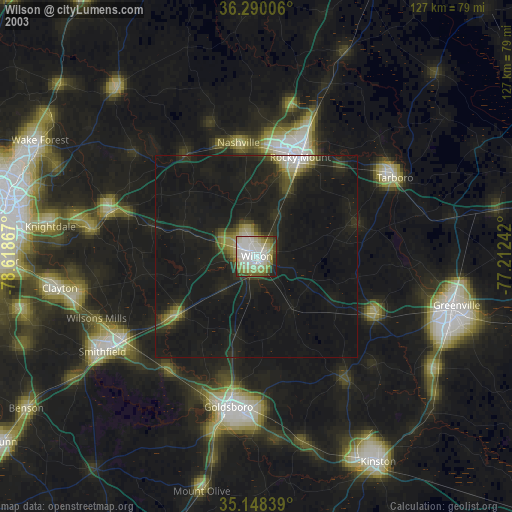
» NASA city lights 2003
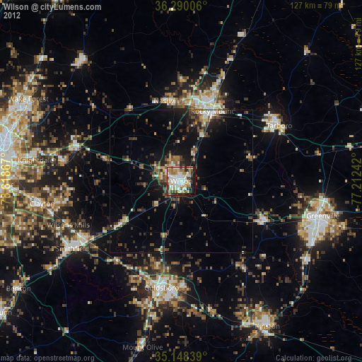
» Earth at Night: Flat Maps 2012, 2016