Tarboro night lights from space
Night Light of Tarboro (North Carolina) from space (United States) Src. Average luminocity for 10x10km area is 40.6282% and for 50x50km: 7.5318%.
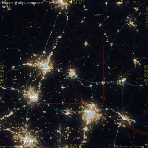
Analysis of Tarboro night lights 2016
Square area 10x10 km:
 6.04%
6.04%90-99
5.68%80-89
8.24%70-79
6.59%60-69
9.71%50-59
2.56%40-49
2.93%30-39
4.58%20-29
5.49%10-19
31.14%0-9
17.03%Square area 50x50 km:
0.82%90-99
0.73%80-89
1.23%70-79
0.87%60-69
1.03%50-59
0.69%40-49
1.16%30-39
1.54%20-29
2.09%10-19
6.05%0-9
83.78%Clear (daylight) street map image can be seen on geolist.org.
Map coordinates:
36° 27' 51.7" North, 78° 14' 20.1" West
35° 53' 48.6" North, 77° 32' 8.9" West
35° 19' 30.7" North, 76° 49' 57.6" West
Some cities around Tarboro sort by population:
• Greenville
35.1 km =21.8 mi,  154°
154°
• Rocky Mount
23.4 km =14.5 mi,  281°
281°
• Wilson
39.4 km =24.5 mi,  240°
240°
• Washington
58.5 km =36.4 mi,  131°
131°
• Winterville
42.7 km =26.5 mi,  163°
163°
• Williamston
43.5 km =27 mi,  96°
96°
• Nashville
39.6 km =24.6 mi, 282°
• Ayden
48.4 km =30.1 mi,  167°
167°
4494513 (p: 11,164)
Sources (retrieved 2019-11-25):
» Earth at Night: Flat Maps 2012, 2016