Henderson night lights from space
Night Light of Henderson (North Carolina) from space (United States) Src. Average luminocity for 10x10km area is 51.2727% and for 50x50km: 6.9617%.
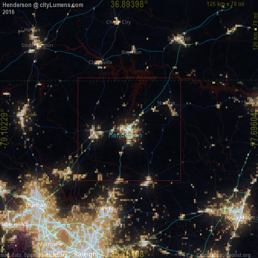
Analysis of Henderson night lights 2016
Square area 10x10 km:
 7.52%
7.52%90-99
6.64%80-89
7.34%70-79
8.04%60-69
12.06%50-59
8.39%40-49
7.17%30-39
10.14%20-29
15.21%10-19
17.13%0-9
0.35%Square area 50x50 km:
0.45%90-99
0.43%80-89
0.84%70-79
1.02%60-69
1.25%50-59
1.05%40-49
0.91%30-39
1.98%20-29
1.78%10-19
4.8%0-9
85.48%Clear (daylight) street map image can be seen on geolist.org.
Map coordinates:
36° 53' 38.3" North, 79° 6' 8.2" West
36° 19' 46.5" North, 78° 23' 57" West
35° 45' 39.9" North, 77° 41' 45.7" West
Some cities around Henderson sort by population:
• Durham
58.3 km =36.2 mi,  230°
230°
• Wake Forest
40.1 km =24.9 mi,  194°
194°
• Knightdale
60.7 km =37.7 mi, 186°
• Oxford
17.3 km =10.7 mi,  263°
263°
• Roxboro
52.7 km =32.7 mi,  277°
277°
• Butner
38.9 km =24.2 mi,  235°
235°
• Rolesville
45.5 km =28.3 mi, 186°
• Nashville
55.4 km =34.4 mi,  135°
135°
4470566 (p: 15,271)
Sources (retrieved 2019-11-25):
» Earth at Night: Flat Maps 2012, 2016