Nashville night lights from space
Night Light of Nashville (North Carolina) from space (United States) Src. Average luminocity for 10x10km area is 28.2674% and for 50x50km: 12.8739%.
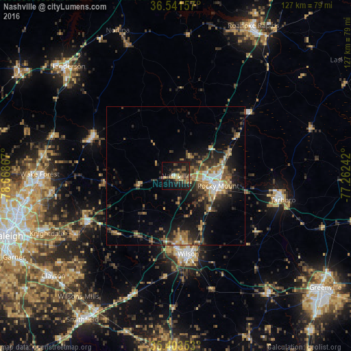
Analysis of Nashville night lights 2016
Square area 10x10 km:
 0.73%
0.73%90-99
1.83%80-89
2.75%70-79
5.13%60-69
5.68%50-59
4.03%40-49
6.23%30-39
11.17%20-29
6.41%10-19
28.57%0-9
27.47%Square area 50x50 km:
1.12%90-99
1.02%80-89
1.56%70-79
1.92%60-69
2.39%50-59
1.81%40-49
2.25%30-39
3.52%20-29
4.07%10-19
8.13%0-9
72.22%Clear (daylight) street map image can be seen on geolist.org.
Map coordinates:
36° 32' 29.7" North, 78° 40' 7.2" West
35° 58' 28.6" North, 77° 57' 55.9" West
35° 24' 12.7" North, 77° 15' 44.7" West
Some cities around Nashville sort by population:
• Rocky Mount
16.3 km =10.1 mi,  104°
104°
• Wilson
28.5 km =17.7 mi,  170°
170°
• Wake Forest
49 km =30.4 mi,  270°
270°
• Henderson
55.4 km =34.4 mi,  315°
315°
• Knightdale
50.8 km =31.6 mi,  245°
245°
• Tarboro
39.6 km =24.6 mi, 102°
• Rolesville
44.6 km =27.7 mi,  262°
262°
• Wendell
42.3 km =26.3 mi,  239°
239°
4481519 (p: 5,460)
Sources (retrieved 2019-11-25):
» Earth at Night: Flat Maps 2012, 2016