Redding night lights from space
Night Light of Redding (California) from space (United States) Src. Average luminocity for 10x10km area is 56.7338% and for 50x50km: 5.8013%.
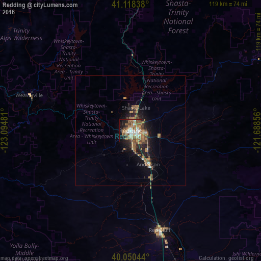
Analysis of Redding night lights 2016
Square area 10x10 km:
 9.74%
9.74%90-99
9.42%80-89
5.19%70-79
8.28%60-69
18.18%50-59
11.36%40-49
10.88%30-39
1.79%20-29
7.31%10-19
14.61%0-9
3.25%Square area 50x50 km:
0.48%90-99
0.5%80-89
0.33%70-79
0.99%60-69
1.62%50-59
1.12%40-49
1.1%30-39
0.85%20-29
1.36%10-19
4.32%0-9
87.34%Clear (daylight) street map image can be seen on geolist.org.
Map coordinates:
41° 7' 6.2" North, 123° 5' 41.3" West
40° 35' 11.5" North, 122° 23' 30" West
40° 3' 1.6" North, 121° 41' 18.8" West
Some cities around Redding sort by population:
• Chico
106.4 km =66.1 mi,  153°
153°
• Paradise
112.8 km =70.1 mi,  144°
144°
• Red Bluff
47.3 km =29.4 mi,  163°
163°
• Magalia
110.4 km =68.6 mi, 141°
• Anderson
17.3 km =10.7 mi, 152°
• Shasta Lake
10.6 km =6.6 mi,  9°
9°
• Orland
94.8 km =58.9 mi,  169°
169°
• Corning
75.4 km =46.9 mi, 166°
5570160 (p: 91,582)
Sources (retrieved 2019-11-25):
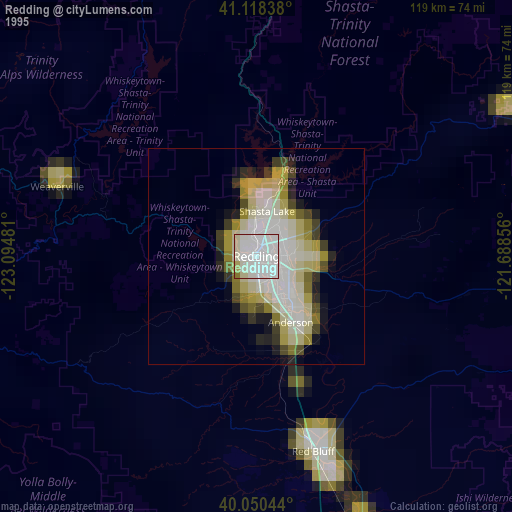
» NASA, Earths city lights 1995
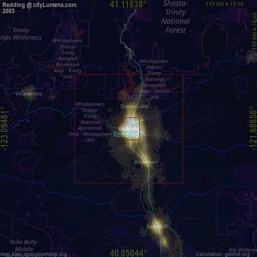
» NASA city lights 2003
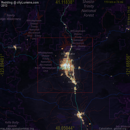
» Earth at Night: Flat Maps 2012, 2016