Magalia night lights from space
Night Light of Magalia (California) from space (United States) Src. Average luminocity for 10x10km area is 5.8418% and for 50x50km: 3.0525%.
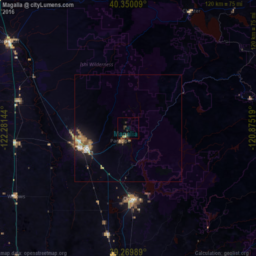
Analysis of Magalia night lights 2016
Square area 10x10 km:
 0%
0%90-99
0%80-89
0.68%70-79
1.53%60-69
0.17%50-59
0%40-49
2.04%30-39
4.42%20-29
0.68%10-19
1.53%0-9
88.95%Square area 50x50 km:
0.27%90-99
0.38%80-89
0.24%70-79
0.66%60-69
0.56%50-59
0.51%40-49
0.42%30-39
0.47%20-29
0.72%10-19
2.04%0-9
93.72%Clear (daylight) street map image can be seen on geolist.org.
Map coordinates:
40° 21' 0.3" North, 122° 16' 53.2" West
39° 48' 43.6" North, 121° 34' 41.9" West
39° 16' 11.6" North, 120° 52' 30.7" West
Some cities around Magalia sort by population:
• Chico
24 km =14.9 mi,  247°
247°
• Paradise
6.9 km =4.3 mi,  212°
212°
• Oroville
33.2 km =20.6 mi,  176°
176°
• Oroville East
34.6 km =21.5 mi,  165°
165°
• Thermalito
33.5 km =20.8 mi, 181°
• South Oroville
35.2 km =21.9 mi, 176°
• Durham
26.4 km =16.4 mi,  225°
225°
• Palermo
42 km =26.1 mi, 175°
5369690 (p: 11,310)
Sources (retrieved 2019-11-25):
» Earth at Night: Flat Maps 2012, 2016