Corning night lights from space
Night Light of Corning (California) from space (United States) Src. Average luminocity for 10x10km area is 9.6446% and for 50x50km: 1.4366%.
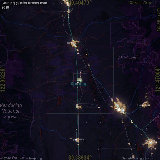
Analysis of Corning night lights 2016
Square area 10x10 km:
 0.68%
0.68%90-99
0.68%80-89
1.36%70-79
1.02%60-69
2.38%50-59
1.19%40-49
2.89%30-39
1.36%20-29
0.51%10-19
2.21%0-9
85.71%Square area 50x50 km:
0.07%90-99
0.07%80-89
0.11%70-79
0.35%60-69
0.2%50-59
0.29%40-49
0.21%30-39
0.24%20-29
0.17%10-19
0.84%0-9
97.46%Clear (daylight) street map image can be seen on geolist.org.
Map coordinates:
40° 27' 53" North, 122° 52' 56.2" West
39° 55' 39.6" North, 122° 10' 45" West
39° 23' 10.8" North, 121° 28' 33.7" West
Some cities around Corning sort by population:
• Chico
36.6 km =22.7 mi,  127°
127°
• Paradise
51.1 km =31.8 mi,  111°
111°
• Red Bluff
28.3 km =17.6 mi,  350°
350°
• Magalia
52.9 km =32.9 mi,  104°
104°
• Anderson
58.8 km =36.5 mi, 350°
• Orland
20.1 km =12.5 mi,  184°
184°
• Willows
44.9 km =27.9 mi, 181°
• Durham
45 km =28 mi, 134°
5339614 (p: 7,548)
Sources (retrieved 2019-11-25):
» Earth at Night: Flat Maps 2012, 2016