Quartz Hill night lights from space
Night Light of Quartz Hill (California) from space (United States) Src. Average luminocity for 10x10km area is 62.4773% and for 50x50km: 16.3071%.
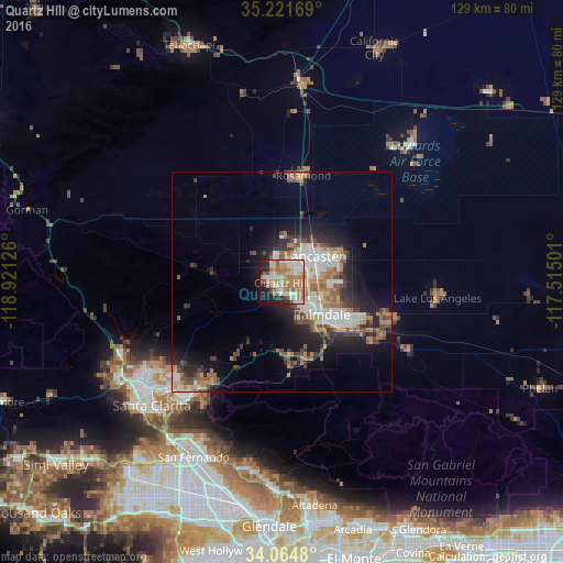
Analysis of Quartz Hill night lights 2016
Square area 10x10 km:
 10.84%
90-99
13.64%80-89
9.44%70-79
8.39%60-69
20.45%50-59
7.69%40-49
4.72%30-39
1.57%20-29
8.22%10-19
13.11%0-9
1.92%Square area 50x50 km:
2.76%90-99
2.95%80-89
1.39%70-79
1.68%60-69
3.44%50-59
2.35%40-49
2.41%30-39
2.32%20-29
4.05%10-19
7.89%0-9
68.75%Clear (daylight) street map image can be seen on geolist.org.
Map coordinates:
35° 13' 18.1" North, 118° 55' 16.5" West
34° 38' 42.9" North, 118° 13' 5.3" West
34° 3' 53.3" North, 117° 30' 54" West
Some cities around Quartz Hill sort by population:
• Santa Clarita
41 km =25.5 mi,  226°
226°
• Lancaster
9.5 km =5.9 mi,  51°
51°
• Palmdale
11.8 km =7.3 mi,  128°
128°
• Castaic
40.9 km =25.4 mi,  244°
244°
• Rosamond
24.8 km =15.4 mi,  11°
11°
• Lake Los Angeles
35.9 km =22.3 mi,  95°
95°
• Sun Village
25.8 km =16 mi,  111°
111°
• Acton
19.6 km =12.2 mi,  174°
174°
5385393 (p: 10,912)
Sources (retrieved 2019-11-25):
» Earth at Night: Flat Maps 2012, 2016