Rosamond night lights from space
Night Light of Rosamond (California) from space (United States) Src. Average luminocity for 10x10km area is 13.4084% and for 50x50km: 8.3008%.
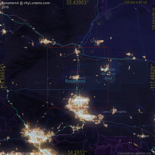
Analysis of Rosamond night lights 2016
Square area 10x10 km:
 0%
0%90-99
0%80-89
0%70-79
3.11%60-69
6.04%50-59
4.95%40-49
2.93%30-39
0.55%20-29
1.47%10-19
0.73%0-9
80.22%Square area 50x50 km:
1.58%90-99
1.54%80-89
0.6%70-79
1%60-69
1.83%50-59
0.98%40-49
1.04%30-39
0.98%20-29
1.54%10-19
3.22%0-9
85.69%Clear (daylight) street map image can be seen on geolist.org.
Map coordinates:
35° 26' 20.5" North, 118° 51' 59.5" West
34° 51' 50.9" North, 118° 9' 48.3" West
34° 17' 6.7" North, 117° 27' 37" West
Some cities around Rosamond sort by population:
• Lancaster
18.6 km =11.6 mi,  172°
172°
• Palmdale
31.9 km =19.8 mi, 172°
• California City
33.3 km =20.7 mi,  29°
29°
• Tehachapi
39.6 km =24.6 mi,  318°
318°
• Lake Los Angeles
41.5 km =25.8 mi,  132°
132°
• Sun Village
38.8 km =24.1 mi,  150°
150°
• Quartz Hill
24.8 km =15.4 mi,  191°
191°
• Golden Hills
42.9 km =26.7 mi, 316°
5388735 (p: 18,150)
Sources (retrieved 2019-11-25):
» Earth at Night: Flat Maps 2012, 2016