Palmdale night lights from space
Night Light of Palmdale (California) from space (United States) Src. Average luminocity for 10x10km area is 73.2448% and for 50x50km: 14.8974%.
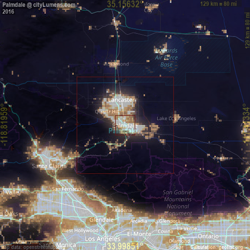
Analysis of Palmdale night lights 2016
Square area 10x10 km:
 18.53%
90-99
19.41%80-89
9.62%70-79
8.04%60-69
14.51%50-59
10.84%40-49
7.17%30-39
4.9%20-29
6.12%10-19
0.87%0-9
0%Square area 50x50 km:
2.68%90-99
2.71%80-89
1.2%70-79
1.36%60-69
3.26%50-59
1.89%40-49
2.15%30-39
2.05%20-29
3.69%10-19
7.55%0-9
71.47%Clear (daylight) street map image can be seen on geolist.org.
Map coordinates:
35° 9' 22.8" North, 118° 49' 10.5" West
34° 34' 45.9" North, 118° 6' 59.3" West
33° 59' 54.6" North, 117° 24' 48" West
Some cities around Palmdale sort by population:
• Lancaster
13.3 km =8.3 mi,  351°
351°
• Tujunga
39.7 km =24.7 mi,  203°
203°
• Rosamond
31.9 km =19.8 mi, 352°
• Sunland
38.7 km =24 mi,  206°
206°
• Lake Los Angeles
26.6 km =16.5 mi,  82°
82°
• Sun Village
14.8 km =9.2 mi,  98°
98°
• Quartz Hill
11.8 km =7.3 mi,  308°
308°
• Acton
14.2 km =8.8 mi, 211°
5380698 (p: 158,351)
Sources (retrieved 2019-11-25):
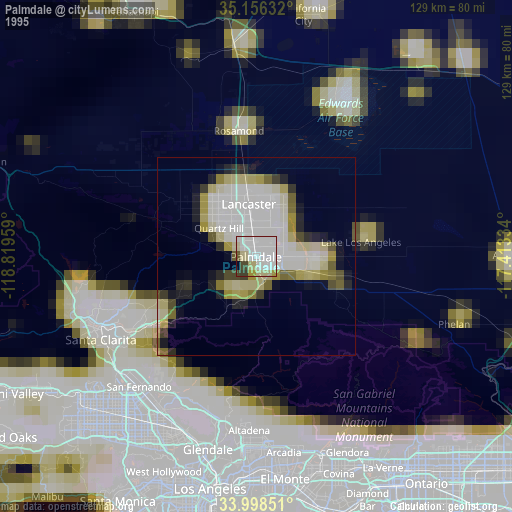
» NASA, Earths city lights 1995
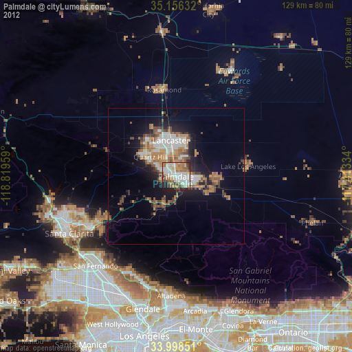
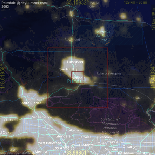
» NASA city lights 2003
» Earth at Night: Flat Maps 2012, 2016