Acton night lights from space
Night Light of Acton (California) from space (United States) Src. Average luminocity for 10x10km area is 14.5909% and for 50x50km: 19.2968%.
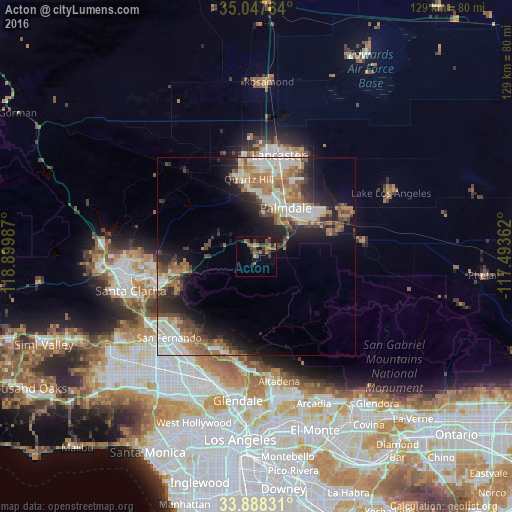
Analysis of Acton night lights 2016
Square area 10x10 km:
 0%
0%90-99
0%80-89
0.7%70-79
0.7%60-69
4.9%50-59
4.55%40-49
4.9%30-39
4.72%20-29
2.62%10-19
8.74%0-9
68.18%Square area 50x50 km:
3.52%90-99
3.68%80-89
1.57%70-79
1.84%60-69
3.98%50-59
2.9%40-49
2.99%30-39
2.88%20-29
4.34%10-19
8.56%0-9
63.73%Clear (daylight) street map image can be seen on geolist.org.
Map coordinates:
35° 2' 51.5" North, 118° 53' 59.5" West
34° 28' 12" North, 118° 11' 48.3" West
33° 53' 17.9" North, 117° 29' 37" West
Some cities around Acton sort by population:
• Lancaster
25.9 km =16.1 mi,  12°
12°
• Palmdale
14.2 km =8.8 mi,  31°
31°
• Tujunga
25.6 km =15.9 mi,  199°
199°
• La Crescenta-Montrose
26.7 km =16.6 mi,  187°
187°
• Sunland
24.6 km =15.3 mi, 203°
• Shadow Hills
27.2 km =16.9 mi,  211°
211°
• Sun Village
24.1 km =15 mi,  65°
65°
• Quartz Hill
19.6 km =12.2 mi,  354°
354°
5322317 (p: 7,596)
Sources (retrieved 2019-11-25):
» Earth at Night: Flat Maps 2012, 2016