Santa Clarita night lights from space
Night Light of Santa Clarita (California) from space (United States) Src. Average luminocity for 10x10km area is 76.9817% and for 50x50km: 35.7837%.
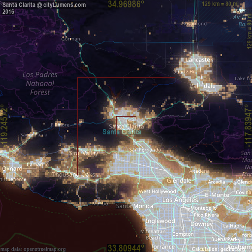
Analysis of Santa Clarita night lights 2016
Square area 10x10 km:
 21.98%
90-99
24.54%80-89
5.49%70-79
8.79%60-69
15.75%50-59
8.42%40-49
4.95%30-39
4.4%20-29
5.49%10-19
0.18%0-9
0%Square area 50x50 km:
9.11%90-99
7.97%80-89
3.31%70-79
3.78%60-69
6.73%50-59
4.82%40-49
3.95%30-39
4.16%20-29
6.45%10-19
7.14%0-9
42.58%Clear (daylight) street map image can be seen on geolist.org.
Map coordinates:
34° 58' 11.5" North, 119° 14' 44.6" West
34° 23' 30" North, 118° 32' 33.3" West
33° 48' 34" North, 117° 50' 22.1" West
Some cities around Santa Clarita sort by population:
• Valencia
8.4 km =5.2 mi,  313°
313°
• Northridge
18.2 km =11.3 mi,  178°
178°
• Canoga Park
21.8 km =13.5 mi,  193°
193°
• North Hills
18.1 km =11.2 mi,  162°
162°
• Chatsworth
15.9 km =9.9 mi,  199°
199°
• San Fernando
15.5 km =9.6 mi,  142°
142°
• Castaic
13.1 km =8.1 mi,  325°
325°
• Stevenson Ranch
2.9 km =1.8 mi,  267°
267°
5393049 (p: 182,371)
Sources (retrieved 2019-11-25):
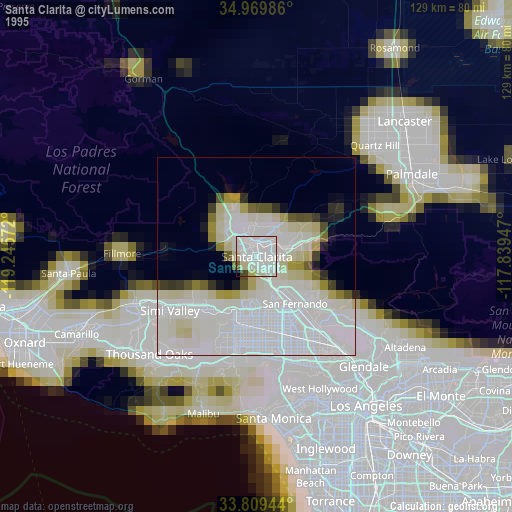
» NASA, Earths city lights 1995
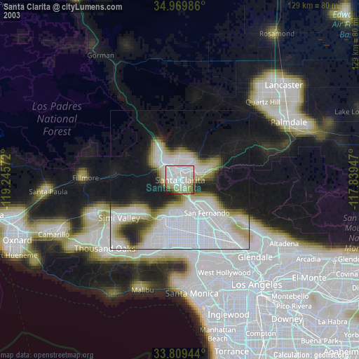
» NASA city lights 2003
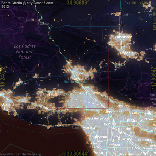
» Earth at Night: Flat Maps 2012, 2016