Pierre night lights from space
Night Light of Pierre (South Dakota) from space (United States) Src. Average luminocity for 10x10km area is 32.5365% and for 50x50km: 1.6069%.
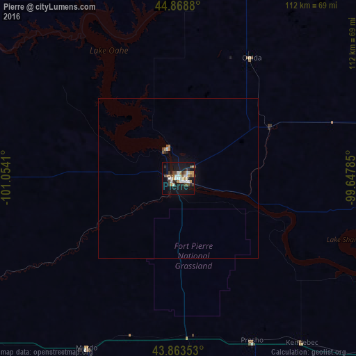
Analysis of Pierre night lights 2016
Square area 10x10 km:
 5.24%
5.24%90-99
7.3%80-89
2.06%70-79
5.4%60-69
2.22%50-59
4.13%40-49
5.08%30-39
3.49%20-29
2.22%10-19
40.32%0-9
22.54%Square area 50x50 km:
0.23%90-99
0.28%80-89
0.09%70-79
0.23%60-69
0.14%50-59
0.23%40-49
0.23%30-39
0.18%20-29
0.1%10-19
1.69%0-9
96.61%Clear (daylight) street map image can be seen on geolist.org.
Map coordinates:
44° 52' 7.7" North, 101° 3' 14.8" West
44° 22' 6" North, 100° 21' 3.5" West
43° 51' 48.7" North, 99° 38' 52.3" West
Some cities around Pierre sort by population:
• Rapid City
231.7 km =144 mi,  262°
262°
• Aberdeen
190.8 km =118.6 mi,  50°
50°
• Mitchell
199.5 km =124 mi,  111°
111°
• Huron
169.8 km =105.5 mi,  90°
90°
• Box Elder
218.3 km =135.6 mi, 262°
• Rapid Valley
225.3 km =140 mi, 261°
• Madison
261.2 km =162.3 mi,  98°
98°
• Sturgis
251 km =156 mi,  271°
271°
5767918 (p: 14,002)
Sources (retrieved 2019-11-25):
» Earth at Night: Flat Maps 2012, 2016