Mitchell night lights from space
Night Light of Mitchell (South Dakota) from space (United States) Src. Average luminocity for 10x10km area is 32.5818% and for 50x50km: 1.6441%.
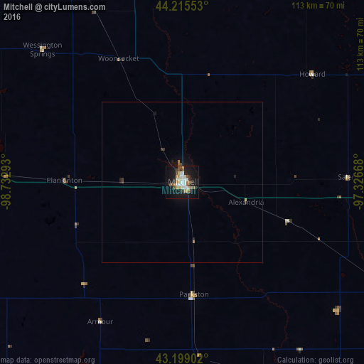
Analysis of Mitchell night lights 2016
Square area 10x10 km:
 5.3%
5.3%90-99
7.12%80-89
2.88%70-79
4.39%60-69
3.33%50-59
4.55%40-49
2.73%30-39
3.94%20-29
3.94%10-19
36.52%0-9
25.3%Square area 50x50 km:
0.22%90-99
0.29%80-89
0.14%70-79
0.18%60-69
0.19%50-59
0.2%40-49
0.16%30-39
0.23%20-29
0.28%10-19
1.73%0-9
96.37%Clear (daylight) street map image can be seen on geolist.org.
Map coordinates:
44° 12' 55.9" North, 98° 43' 58.5" West
43° 42' 33.9" North, 98° 1' 47.3" West
43° 11' 56.5" North, 97° 19' 36" West
Some cities around Mitchell sort by population:
• Sioux Falls
108.5 km =67.4 mi,  99°
99°
• Brookings
119.1 km =74 mi,  55°
55°
• Yankton
106.3 km =66.1 mi,  151°
151°
• Huron
74.2 km =46.1 mi,  348°
348°
• Vermillion
136.5 km =84.8 mi,  139°
139°
• Brandon
118 km =73.3 mi, 96°
• Madison
80.5 km =50 mi,  65°
65°
• Harrisburg
111.7 km =69.4 mi,  106°
106°
5229794 (p: 15,669)
Sources (retrieved 2019-11-25):
» Earth at Night: Flat Maps 2012, 2016