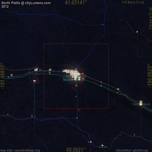
North Platte night lights from space
Night Light of North Platte (Nebraska) from space (United States) Src. Average luminocity for 10x10km area is 47.8831% and for 50x50km: 3.0364%.

Analysis of North Platte night lights 2016
Square area 10x10 km:
 7.63%
7.63%90-99
11.69%80-89
8.44%70-79
3.9%60-69
5.19%50-59
6.98%40-49
4.22%30-39
7.63%20-29
13.15%10-19
26.95%0-9
4.22%Square area 50x50 km:
0.36%90-99
0.6%80-89
0.44%70-79
0.29%60-69
0.25%50-59
0.35%40-49
0.25%30-39
0.59%20-29
0.69%10-19
2.82%0-9
93.34%Clear (daylight) street map image can be seen on geolist.org.
Map coordinates:
41° 39' 5.1" North, 101° 28' 6.8" West
41° 7' 26" North, 100° 45' 55.5" West
40° 35' 31.6" North, 100° 3' 44.3" West
Some cities around North Platte sort by population:
• Grand Island
204.5 km =127.1 mi,  96°
96°
• Kearney
149.2 km =92.7 mi,  108°
108°
• Lexington
94.1 km =58.5 mi, 113°
• Alliance
206.1 km =128.1 mi,  301°
301°
• McCook
103.2 km =64.1 mi,  173°
173°
• Sidney
185.3 km =115.1 mi,  270°
270°
• Holdrege
139.9 km =86.9 mi,  122°
122°
• Colby
193.7 km =120.4 mi,  187°
187°
5697939 (p: 24,194)
Sources (retrieved 2019-11-25):
» Earth at Night: Flat Maps 2012, 2016