Norcross night lights from space
Night Light of Norcross (Georgia) from space (United States) Src. Average luminocity for 10x10km area is 96.6049% and for 50x50km: 85.1549%.
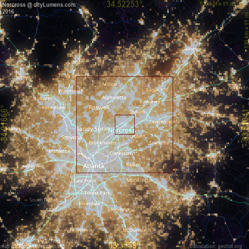
Analysis of Norcross night lights 2016
Square area 10x10 km:
 57.69%
90-99
26.05%80-89
14.16%70-79
2.1%60-69
0%50-59
0%40-49
0%30-39
0%20-29
0%10-19
0%0-9
0%Square area 50x50 km:
24.22%90-99
22.61%80-89
19.05%70-79
20.61%60-69
8.32%50-59
2.16%40-49
1.4%30-39
0.68%20-29
0.87%10-19
0.08%0-9
0%Clear (daylight) street map image can be seen on geolist.org.
Map coordinates:
34° 31' 21.1" North, 84° 54' 60" West
33° 56' 28.4" North, 84° 12' 48.7" West
33° 21' 21.2" North, 83° 30' 37.5" West
Some cities around Norcross sort by population:
• Johns Creek
9.9 km =6.2 mi,  8°
8°
• Dunwoody
11.2 km =7 mi,  272°
272°
• Peachtree Corners
3.3 km =2.1 mi,  346°
346°
• Duluth
9.3 km =5.8 mi,  42°
42°
• Chamblee
9.6 km =6 mi,  235°
235°
• Tucker
9.6 km =6 mi,  181°
181°
• Lilburn
8.6 km =5.3 mi,  131°
131°
• Doraville
8 km =5 mi,  233°
233°
4212888 (p: 16,634)
Sources (retrieved 2019-11-25):
» Earth at Night: Flat Maps 2012, 2016