Lilburn night lights from space
Night Light of Lilburn (Georgia) from space (United States) Src. Average luminocity for 10x10km area is 86.0559% and for 50x50km: 83.022%.
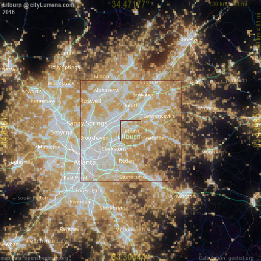
Analysis of Lilburn night lights 2016
Square area 10x10 km:
 16.96%
90-99
23.95%80-89
20.8%70-79
36.36%60-69
1.92%50-59
0%40-49
0%30-39
0%20-29
0%10-19
0%0-9
0%Square area 50x50 km:
23.28%90-99
21.9%80-89
18.08%70-79
18.87%60-69
8.96%50-59
2.53%40-49
2.12%30-39
1.55%20-29
1.83%10-19
0.88%0-9
0%Clear (daylight) street map image can be seen on geolist.org.
Map coordinates:
34° 28' 18.4" North, 84° 50' 46" West
33° 53' 24.4" North, 84° 8' 34.7" West
33° 18' 16" North, 83° 26' 23.5" West
Some cities around Lilburn sort by population:
• Peachtree Corners
11.5 km =7.1 mi,  320°
320°
• Duluth
12.5 km =7.8 mi,  359°
359°
• Tucker
7.9 km =4.9 mi,  240°
240°
• Snellville
11.9 km =7.4 mi,  107°
107°
• Norcross
8.6 km =5.3 mi,  311°
311°
• Clarkston
12.6 km =7.8 mi,  224°
224°
• Mountain Park
5.2 km =3.2 mi,  166°
166°
• Stone Mountain
9.5 km =5.9 mi,  195°
195°
4205724 (p: 12,655)
Sources (retrieved 2019-11-25):
» Earth at Night: Flat Maps 2012, 2016