Mays Chapel night lights from space
Night Light of Mays Chapel (Maryland) from space (United States) Src. Average luminocity for 10x10km area is 78.2789% and for 50x50km: 48.5904%.
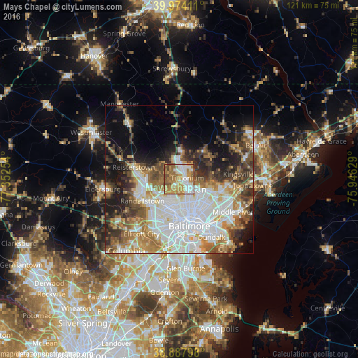
Analysis of Mays Chapel night lights 2016
Square area 10x10 km:
 18.2%
18.2%90-99
16.67%80-89
6.97%70-79
25%60-69
16.67%50-59
11.05%40-49
5.44%30-39
0%20-29
0%10-19
0%0-9
0%Square area 50x50 km:
14.84%90-99
9.81%80-89
4.97%70-79
5.94%60-69
6.35%50-59
5.77%40-49
5.67%30-39
5.9%20-29
6.72%10-19
10.56%0-9
23.46%Clear (daylight) street map image can be seen on geolist.org.
Map coordinates:
39° 58' 26.8" North, 77° 21' 9.1" West
39° 25' 59.4" North, 76° 38' 57.9" West
38° 53' 16.7" North, 75° 56' 46.6" West
Some cities around Mays Chapel sort by population:
• Towson
5.4 km =3.4 mi,  130°
130°
• Pikesville
9.1 km =5.7 mi,  223°
223°
• Hunt Valley
7.4 km =4.6 mi,  5°
5°
• Cockeysville
5.4 km =3.4 mi, 5°
• Lutherville-Timonium
3.4 km =2.1 mi,  77°
77°
• Timonium
2.6 km =1.6 mi, 80°
• Lutherville
2.4 km =1.5 mi,  123°
123°
• Hampton
5.7 km =3.5 mi,  101°
101°
4362009 (p: 11,420)
Sources (retrieved 2019-11-25):
» Earth at Night: Flat Maps 2012, 2016