Marlborough night lights from space
Night Light of Marlborough (Massachusetts) from space (United States) Src. Average luminocity for 10x10km area is 60.9619% and for 50x50km: 37.002%.
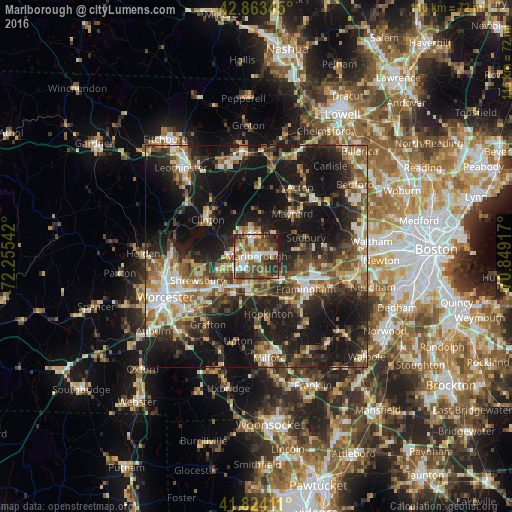
Analysis of Marlborough night lights 2016
Square area 10x10 km:
 9.05%
9.05%90-99
14.13%80-89
4.92%70-79
8.73%60-69
5.24%50-59
18.1%40-49
16.35%30-39
12.06%20-29
10.79%10-19
0.63%0-9
0%Square area 50x50 km:
4.21%90-99
5.78%80-89
4.47%70-79
4.02%60-69
5.11%50-59
6.93%40-49
6.86%30-39
6.92%20-29
13.35%10-19
28.3%0-9
14.04%Clear (daylight) street map image can be seen on geolist.org.
Map coordinates:
42° 51' 48.4" North, 72° 15' 19.5" West
42° 20' 45.3" North, 71° 33' 8.2" West
41° 49' 26.8" North, 70° 50' 57" West
Some cities around Marlborough sort by population:
• Framingham Center
10.9 km =6.8 mi,  119°
119°
• Sudbury
11.9 km =7.4 mi,  69°
69°
• Ashland
11.9 km =7.4 mi,  142°
142°
• Hudson
5.2 km =3.2 mi,  347°
347°
• Maynard
12.9 km =8 mi,  40°
40°
• Southborough
5 km =3.1 mi,  152°
152°
• Northborough
7.9 km =4.9 mi,  248°
248°
• Stow
10.8 km =6.7 mi,  20°
20°
4943170 (p: 39,818)
Sources (retrieved 2019-11-25):
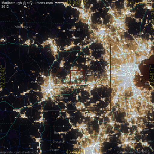
» Earth at Night: Flat Maps 2012, 2016