Ashland night lights from space
Night Light of Ashland (Massachusetts) from space (United States) Src. Average luminocity for 10x10km area is 50.0909% and for 50x50km: 40.3082%.
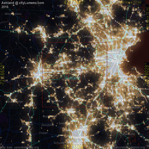
Analysis of Ashland night lights 2016
Square area 10x10 km:
 8.18%
8.18%90-99
9.7%80-89
5.45%70-79
4.39%60-69
5.61%50-59
8.79%40-49
12.73%30-39
10.3%20-29
21.52%10-19
13.33%0-9
0%Square area 50x50 km:
4.36%90-99
6.31%80-89
5.26%70-79
4.96%60-69
6.33%50-59
7.17%40-49
7.63%30-39
8.62%20-29
14.73%10-19
22.52%0-9
12.12%Clear (daylight) street map image can be seen on geolist.org.
Map coordinates:
42° 46' 45.9" North, 72° 9' 59.5" West
42° 15' 40.4" North, 71° 27' 48.2" West
41° 44' 19.3" North, 70° 45' 37" West
Some cities around Ashland sort by population:
• Framingham
4.4 km =2.7 mi,  62°
62°
• Framingham Center
4.6 km =2.9 mi,  28°
28°
• Marlborough
11.9 km =7.4 mi,  322°
322°
• Natick
9.7 km =6 mi,  75°
75°
• Holliston
7.5 km =4.7 mi,  154°
154°
• Southborough
7 km =4.3 mi,  314°
314°
• Millis
13.6 km =8.5 mi,  140°
140°
• Cochituate
10.5 km =6.5 mi,  50°
50°
4929283 (p: 15,802)
Sources (retrieved 2019-11-25):
» Earth at Night: Flat Maps 2012, 2016