Marion night lights from space
Night Light of Marion (South Carolina) from space (United States) Src. Average luminocity for 10x10km area is 31.848% and for 50x50km: 7.5994%.
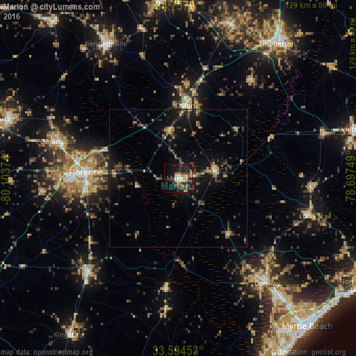
Analysis of Marion night lights 2016
Square area 10x10 km:
 2.38%
2.38%90-99
3.48%80-89
5.13%70-79
4.58%60-69
5.31%50-59
2.2%40-49
7.51%30-39
8.61%20-29
8.06%10-19
28.94%0-9
23.81%Square area 50x50 km:
0.27%90-99
0.32%80-89
0.85%70-79
0.79%60-69
1.27%50-59
0.94%40-49
1.64%30-39
2.7%20-29
2.24%10-19
7.17%0-9
81.82%Clear (daylight) street map image can be seen on geolist.org.
Map coordinates:
34° 45' 28.4" North, 80° 6' 13.5" West
34° 10' 41.6" North, 79° 24' 2.2" West
33° 35' 40.3" North, 78° 41' 51" West
Some cities around Marion sort by population:
• Florence
33.3 km =20.7 mi,  273°
273°
• Lumberton
60.6 km =37.7 mi,  36°
36°
• Conway
50.1 km =31.1 mi,  139°
139°
• Red Hill
23.8 km =14.8 mi,  146°
146°
• Bennettsville
55.4 km =34.4 mi,  331°
331°
• Lake City
47.3 km =29.4 mi,  223°
223°
• Dillon
26.6 km =16.5 mi,  5°
5°
• Darlington
45.8 km =28.5 mi,  287°
287°
4586266 (p: 6,714)
Sources (retrieved 2019-11-25):
» Earth at Night: Flat Maps 2012, 2016