Lake City night lights from space
Night Light of Lake City (South Carolina) from space (United States) Src. Average luminocity for 10x10km area is 38.757% and for 50x50km: 5.9007%.
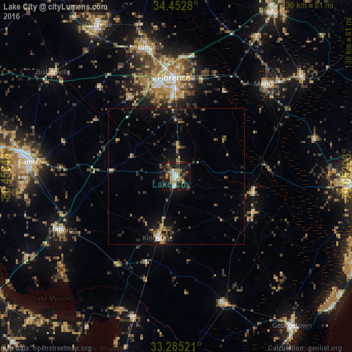
Analysis of Lake City night lights 2016
Square area 10x10 km:
 4.37%
4.37%90-99
5.42%80-89
7.17%70-79
3.67%60-69
8.04%50-59
1.57%40-49
6.29%30-39
11.36%20-29
9.27%10-19
36.71%0-9
6.12%Square area 50x50 km:
0.28%90-99
0.41%80-89
0.66%70-79
0.75%60-69
0.99%50-59
0.41%40-49
1.06%30-39
2.23%20-29
1.65%10-19
5.03%0-9
86.53%Clear (daylight) street map image can be seen on geolist.org.
Map coordinates:
34° 27' 10.1" North, 80° 27' 30.5" West
33° 52' 15.6" North, 79° 45' 19.3" West
33° 17' 6.8" North, 79° 3' 8" West
Some cities around Lake City sort by population:
• Sumter
54.4 km =33.8 mi,  275°
275°
• Florence
36.1 km =22.4 mi,  358°
358°
• Conway
65.4 km =40.6 mi,  93°
93°
• Red Hill
48 km =29.8 mi,  72°
72°
• Georgetown
69.6 km =43.2 mi,  142°
142°
• Hartsville
63.1 km =39.2 mi,  332°
332°
• Marion
47.3 km =29.4 mi,  43°
43°
• Darlington
49 km =30.4 mi,  346°
346°
4584322 (p: 6,788)
Sources (retrieved 2019-11-25):
» Earth at Night: Flat Maps 2012, 2016