Dillon night lights from space
Night Light of Dillon (South Carolina) from space (United States) Src. Average luminocity for 10x10km area is 45.2098% and for 50x50km: 9.5391%.
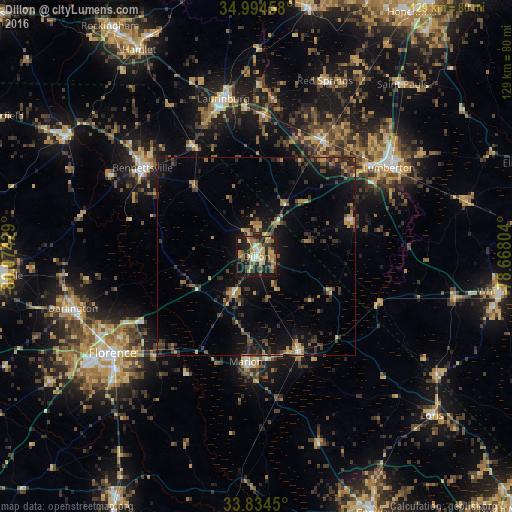
Analysis of Dillon night lights 2016
Square area 10x10 km:
 3.32%
3.32%90-99
4.9%80-89
14.16%70-79
4.55%60-69
9.27%50-59
6.99%40-49
1.92%30-39
7.17%20-29
20.8%10-19
26.75%0-9
0.17%Square area 50x50 km:
0.28%90-99
0.35%80-89
1.17%70-79
1.33%60-69
1.71%50-59
1.11%40-49
1.73%30-39
3.16%20-29
3.28%10-19
8.41%0-9
77.48%Clear (daylight) street map image can be seen on geolist.org.
Map coordinates:
34° 59' 40.5" North, 80° 4' 27.4" West
34° 24' 59.6" North, 79° 22' 16.2" West
33° 50' 4.2" North, 78° 40' 4.9" West
Some cities around Dillon sort by population:
• Florence
43.6 km =27.1 mi,  235°
235°
• Lumberton
39.9 km =24.8 mi,  55°
55°
• Laurinburg
40.6 km =25.2 mi,  348°
348°
• Red Hill
47.5 km =29.5 mi,  167°
167°
• Bennettsville
36.4 km =22.6 mi,  307°
307°
• Marion
26.6 km =16.5 mi,  185°
185°
• Darlington
48.1 km =29.9 mi,  254°
254°
• Cheraw
56.4 km =35 mi,  303°
303°
4576653 (p: 6,677)
Sources (retrieved 2019-11-25):
» Earth at Night: Flat Maps 2012, 2016