Lionville night lights from space
Night Light of Lionville (Pennsylvania) from space (United States) Src. Average luminocity for 10x10km area is 61.2906% and for 50x50km: 39.7952%.
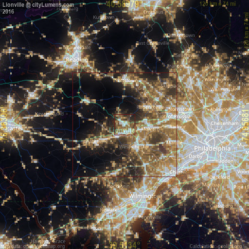
Analysis of Lionville night lights 2016
Square area 10x10 km:
 12.01%
90-99
8.12%80-89
8.77%70-79
7.14%60-69
12.18%50-59
16.4%40-49
12.34%30-39
9.58%20-29
11.2%10-19
2.27%0-9
0%Square area 50x50 km:
4.09%90-99
4.39%80-89
5.76%70-79
6.4%60-69
8.66%50-59
10.24%40-49
7.26%30-39
8.19%20-29
7.8%10-19
12.3%0-9
24.9%Clear (daylight) street map image can be seen on geolist.org.
Map coordinates:
40° 35' 23.2" North, 76° 21' 47" West
40° 3' 13.4" North, 75° 39' 35.7" West
39° 30' 48.2" North, 74° 57' 24.5" West
Some cities around Lionville sort by population:
• Pottstown
21.3 km =13.2 mi,  2°
2°
• West Chester
11.2 km =7 mi,  156°
156°
• Phoenixville
15 km =9.3 mi,  55°
55°
• Coatesville
16 km =9.9 mi,  240°
240°
• Audubon
21.1 km =13.1 mi,  66°
66°
• Downingtown
6.4 km =4 mi,  215°
215°
• Chester Springs
5.9 km =3.7 mi,  38°
38°
• Paoli
15.7 km =9.8 mi,  94°
94°
5198203 (p: 6,189)
Sources (retrieved 2019-11-25):
» Earth at Night: Flat Maps 2012, 2016