Paoli night lights from space
Night Light of Paoli (Pennsylvania) from space (United States) Src. Average luminocity for 10x10km area is 66.7711% and for 50x50km: 61.0402%.
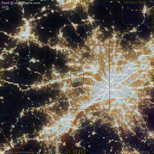
Analysis of Paoli night lights 2016
Square area 10x10 km:
 9.25%
9.25%90-99
10.55%80-89
8.12%70-79
10.55%60-69
15.75%50-59
25.97%40-49
14.29%30-39
5.52%20-29
0%10-19
0%0-9
0%Square area 50x50 km:
12.86%90-99
10.45%80-89
8.48%70-79
10.17%60-69
14.08%50-59
10.97%40-49
7.05%30-39
7.22%20-29
6.25%10-19
6.18%0-9
6.29%Clear (daylight) street map image can be seen on geolist.org.
Map coordinates:
40° 34' 41.6" North, 76° 10' 46" West
40° 2' 31.4" North, 75° 28' 34.7" West
39° 30' 5.9" North, 74° 46' 23.5" West
Some cities around Paoli sort by population:
• Wayne
7.5 km =4.7 mi,  88°
88°
• Radnor
9.9 km =6.2 mi, 87°
• King of Prussia
8.6 km =5.3 mi,  52°
52°
• Phoenixville
10.4 km =6.5 mi,  341°
341°
• West Norriton
12.8 km =8 mi,  40°
40°
• Broomall
12.2 km =7.6 mi,  123°
123°
• Audubon
10.3 km =6.4 mi,  21°
21°
• Chester Springs
13.3 km =8.3 mi,  296°
296°
5205037 (p: 5,575)
Sources (retrieved 2019-11-25):
» Earth at Night: Flat Maps 2012, 2016