Leavenworth night lights from space
Night Light of Leavenworth (Kansas) from space (United States) Src. Average luminocity for 10x10km area is 45.4456% and for 50x50km: 17.1256%.
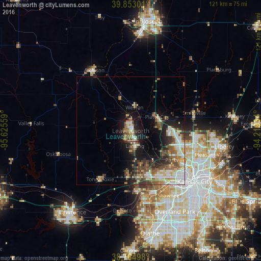
Analysis of Leavenworth night lights 2016
Square area 10x10 km:
 7.65%
7.65%90-99
7.99%80-89
2.89%70-79
7.99%60-69
8.16%50-59
7.48%40-49
8.5%30-39
3.57%20-29
10.71%10-19
31.29%0-9
3.74%Square area 50x50 km:
3.11%90-99
2.92%80-89
1.94%70-79
1.86%60-69
2.5%50-59
2.92%40-49
3.01%30-39
2.8%20-29
3.44%10-19
8%0-9
67.5%Clear (daylight) street map image can be seen on geolist.org.
Map coordinates:
39° 51' 10.8" North, 95° 37' 32.1" West
39° 18' 40" North, 94° 55' 20.9" West
38° 45' 53.9" North, 94° 13' 9.6" West
Some cities around Leavenworth sort by population:
• Kansas City
33.5 km =20.8 mi,  130°
130°
• Lansing
7.2 km =4.5 mi,  164°
164°
• Atchison
32.8 km =20.4 mi,  328°
328°
• Smithville
30.5 km =19 mi,  73°
73°
• Bonner Springs
28.2 km =17.5 mi,  173°
173°
• Parkville
24.4 km =15.2 mi,  121°
121°
• Basehor
18.9 km =11.7 mi,  184°
184°
• Tonganoxie
26.5 km =16.5 mi,  212°
212°
4274305 (p: 35,980)
Sources (retrieved 2019-11-25):
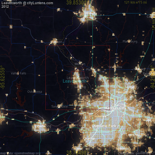
» Earth at Night: Flat Maps 2012, 2016