Parkville night lights from space
Night Light of Parkville (Missouri) from space (United States) Src. Average luminocity for 10x10km area is 66.6185% and for 50x50km: 53.4157%.
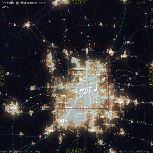
Analysis of Parkville night lights 2016
Square area 10x10 km:
 8.6%
8.6%90-99
11.85%80-89
11.2%70-79
12.99%60-69
16.88%50-59
15.58%40-49
10.06%30-39
7.14%20-29
5.52%10-19
0.16%0-9
0%Square area 50x50 km:
15.19%90-99
12.92%80-89
7.66%70-79
6.02%60-69
6.08%50-59
6.24%40-49
5.21%30-39
4.54%20-29
5.13%10-19
11.13%0-9
19.89%Clear (daylight) street map image can be seen on geolist.org.
Map coordinates:
39° 44' 16.1" North, 95° 23' 7.1" West
39° 11' 42" North, 94° 40' 55.8" West
38° 38' 52.7" North, 93° 58' 44.6" West
Some cities around Parkville sort by population:
• Kansas City
13.9 km =8.6 mi,  139°
139°
• Kansas City
10.2 km =6.3 mi,  152°
152°
• Shawnee
17.4 km =10.8 mi,  190°
190°
• Gladstone
11 km =6.8 mi,  84°
84°
• Lansing
19.7 km =12.2 mi,  287°
287°
• Merriam
19.1 km =11.9 mi,  182°
182°
• Mission
18.7 km =11.6 mi,  173°
173°
• Roeland Park
18 km =11.2 mi, 166°
4402544 (p: 6,296)
Sources (retrieved 2019-11-25):
» Earth at Night: Flat Maps 2012, 2016