Basehor night lights from space
Night Light of Basehor (Kansas) from space (United States) Src. Average luminocity for 10x10km area is 22.8036% and for 50x50km: 30.2356%.
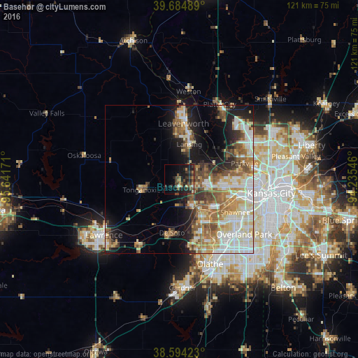
Analysis of Basehor night lights 2016
Square area 10x10 km:
 0.32%
0.32%90-99
1.3%80-89
1.62%70-79
2.44%60-69
5.03%50-59
3.57%40-49
6.49%30-39
9.09%20-29
10.88%10-19
19.48%0-9
39.77%Square area 50x50 km:
5.87%90-99
6.46%80-89
4.56%70-79
3.79%60-69
4.58%50-59
4.33%40-49
3.95%30-39
3.49%20-29
4.23%10-19
9.4%0-9
49.35%Clear (daylight) street map image can be seen on geolist.org.
Map coordinates:
39° 41' 5.6" North, 95° 38' 30.2" West
39° 8' 30" North, 94° 56' 18.9" West
38° 35' 39.2" North, 94° 14' 7.7" West
Some cities around Basehor sort by population:
• Shawnee
21.9 km =13.6 mi,  120°
120°
• Leavenworth
18.9 km =11.7 mi,  4°
4°
• Lansing
12.3 km =7.6 mi,  15°
15°
• Merriam
24.9 km =15.5 mi, 121°
• Bonner Springs
10.3 km =6.4 mi,  152°
152°
• Parkville
22.9 km =14.2 mi,  74°
74°
• De Soto
18.3 km =11.4 mi,  188°
188°
• Tonganoxie
13.3 km =8.3 mi,  254°
254°
4267944 (p: 5,402)
Sources (retrieved 2019-11-25):
» Earth at Night: Flat Maps 2012, 2016