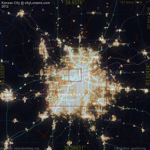
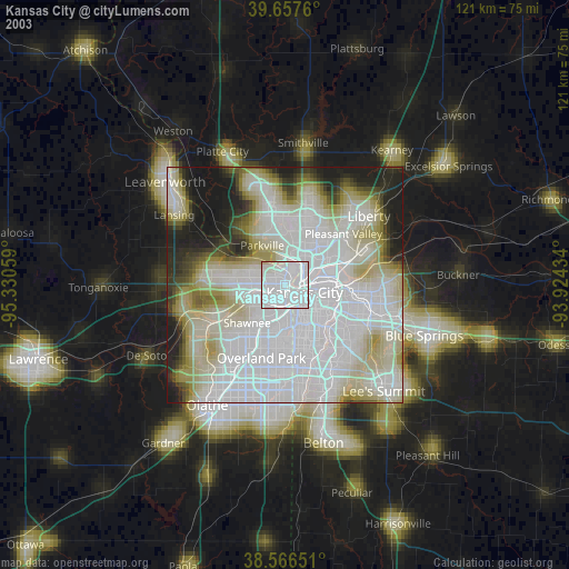
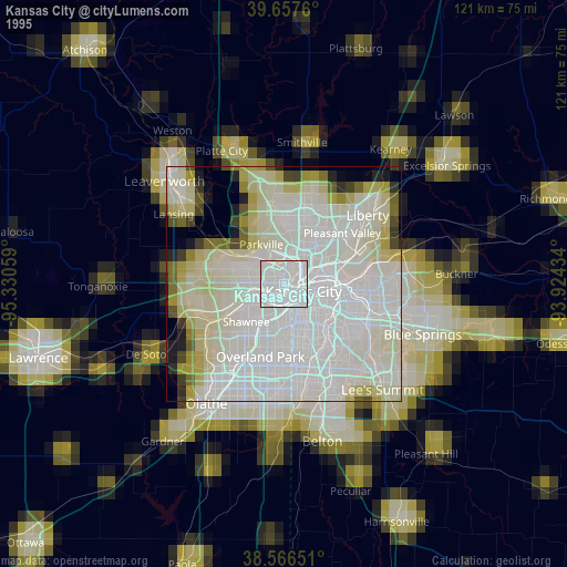
Kansas City night lights from space
Night Light of Kansas City (Kansas) from space (United States) Src. Average luminocity for 10x10km area is 97.0893% and for 50x50km: 66.53%.
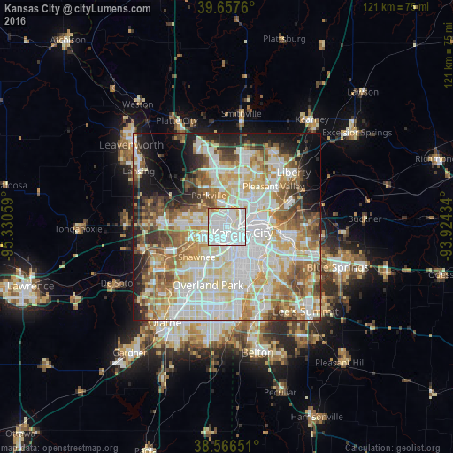
Analysis of Kansas City night lights 2016
Square area 10x10 km:
 60.39%
90-99
29.06%80-89
6.17%70-79
2.6%60-69
0.81%50-59
0.97%40-49
0%30-39
0%20-29
0%10-19
0%0-9
0%Square area 50x50 km:
19.35%90-99
17.9%80-89
9.79%70-79
7.39%60-69
8.19%50-59
7.37%40-49
5.43%30-39
4.89%20-29
5.08%10-19
8%0-9
6.61%Clear (daylight) street map image can be seen on geolist.org.
Map coordinates:
39° 39' 27.4" North, 95° 19' 50.1" West
39° 6' 51" North, 94° 37' 38.9" West
38° 33' 59.4" North, 93° 55' 27.6" West
Some cities around Kansas City sort by population:
• Overland Park
15.1 km =9.4 mi,  194°
194°
• Shawnee
11.4 km =7.1 mi,  224°
224°
• Gladstone
11.8 km =7.3 mi,  32°
32°
• Prairie Village
13.6 km =8.5 mi,  182°
182°
• Merriam
11.6 km =7.2 mi,  209°
209°
• Mission
9.9 km =6.2 mi, 194°
• Roeland Park
8.5 km =5.3 mi, 182°
• Parkville
10.2 km =6.3 mi,  332°
332°
4273837 (p: 151,306)
Sources (retrieved 2019-11-25):
» NASA, Earths city lights 1995
» NASA city lights 2003
» Earth at Night: Flat Maps 2012, 2016