Larchmont night lights from space
Night Light of Larchmont (New York) from space (United States) Src. Average luminocity for 10x10km area is 63.6752% and for 50x50km: 69.0646%.
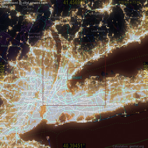
Analysis of Larchmont night lights 2016
Square area 10x10 km:
 11.9%
11.9%90-99
18.71%80-89
9.69%70-79
10.2%60-69
9.52%50-59
4.93%40-49
4.76%30-39
5.27%20-29
15.14%10-19
9.86%0-9
0%Square area 50x50 km:
26.12%90-99
14.51%80-89
6.38%70-79
8.22%60-69
10.79%50-59
7.55%40-49
4.99%30-39
4.76%20-29
5.59%10-19
5.63%0-9
5.45%Clear (daylight) street map image can be seen on geolist.org.
Map coordinates:
41° 27' 25.1" North, 74° 27' 17.7" West
40° 55' 40.4" North, 73° 45' 6.5" West
40° 23' 40.2" North, 73° 2' 55.2" West
Some cities around Larchmont sort by population:
• New Rochelle
3.1 km =1.9 mi,  234°
234°
• Harrison
5.6 km =3.5 mi,  35°
35°
• Eastchester
5.9 km =3.7 mi,  305°
305°
• Mamaroneck
2.8 km =1.7 mi,  34°
34°
• Wykagyl
4.2 km =2.6 mi,  290°
290°
• Pelham
5.1 km =3.2 mi,  246°
246°
• Bronxville
6.8 km =4.2 mi,  279°
279°
• Pelham Manor
5.9 km =3.7 mi, 232°
5124017 (p: 6,132)
Sources (retrieved 2019-11-25):
» Earth at Night: Flat Maps 2012, 2016