Pelham Manor night lights from space
Night Light of Pelham Manor (New York) from space (United States) Src. Average luminocity for 10x10km area is 81.8537% and for 50x50km: 76.2304%.
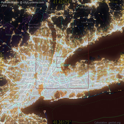
Analysis of Pelham Manor night lights 2016
Square area 10x10 km:
 42.52%
90-99
20.07%80-89
3.06%70-79
7.65%60-69
5.61%50-59
3.23%40-49
4.93%30-39
7.14%20-29
5.78%10-19
0%0-9
0%Square area 50x50 km:
34.26%90-99
15.93%80-89
6.14%70-79
8.5%60-69
11.1%50-59
5.92%40-49
3.61%30-39
3.86%20-29
3.79%10-19
4.05%0-9
2.83%Clear (daylight) street map image can be seen on geolist.org.
Map coordinates:
41° 25' 29.1" North, 74° 30' 36.8" West
40° 53' 43.4" North, 73° 48' 25.5" West
40° 21' 42.3" North, 73° 6' 14.3" West
Some cities around Pelham Manor sort by population:
• New Rochelle
2.7 km =1.7 mi,  49°
49°
• Mount Vernon
3.2 km =2 mi,  307°
307°
• Wakefield
3.8 km =2.4 mi,  274°
274°
• Baychester
3.8 km =2.4 mi,  220°
220°
• Wykagyl
5.2 km =3.2 mi,  7°
7°
• Woodlawn
5.1 km =3.2 mi, 273°
• Bronxville
5.2 km =3.2 mi,  336°
336°
• Larchmont
5.9 km =3.7 mi, 52°
5130862 (p: 5,594)
Sources (retrieved 2019-11-25):
» Earth at Night: Flat Maps 2012, 2016