Laguna Niguel night lights from space
Night Light of Laguna Niguel (California) from space (United States) Src. Average luminocity for 10x10km area is 65.6264% and for 50x50km: 29.8382%.
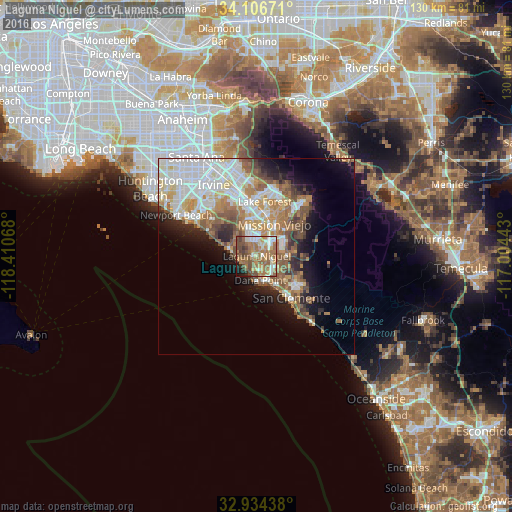
Analysis of Laguna Niguel night lights 2016
Square area 10x10 km:
 8.79%
8.79%90-99
8.97%80-89
7.51%70-79
11.36%60-69
25.46%50-59
17.58%40-49
12.09%30-39
2.75%20-29
1.83%10-19
3.66%0-9
0%Square area 50x50 km:
7.54%90-99
6.43%80-89
2.99%70-79
3.32%60-69
5.75%50-59
4.76%40-49
3.42%30-39
2.07%20-29
3.59%10-19
7.27%0-9
52.85%Clear (daylight) street map image can be seen on geolist.org.
Map coordinates:
34° 6' 24.2" North, 118° 24' 38.4" West
33° 31' 21.1" North, 117° 42' 27.2" West
32° 56' 3.8" North, 117° 0' 15.9" West
Some cities around Laguna Niguel sort by population:
• Mission Viejo
9.2 km =5.7 mi,  20°
20°
• Lake Forest
13.9 km =8.6 mi,  6°
6°
• San Clemente
13.8 km =8.6 mi,  140°
140°
• Aliso Viejo
5.1 km =3.2 mi,  339°
339°
• San Juan Capistrano
4.8 km =3 mi,  119°
119°
• Dana Point
6.2 km =3.9 mi,  171°
171°
• Ladera Ranch
8.6 km =5.3 mi,  51°
51°
• Las Flores
10.5 km =6.5 mi, 45°
5364329 (p: 65,806)
Sources (retrieved 2019-11-25):
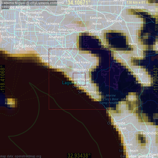
» NASA, Earths city lights 1995
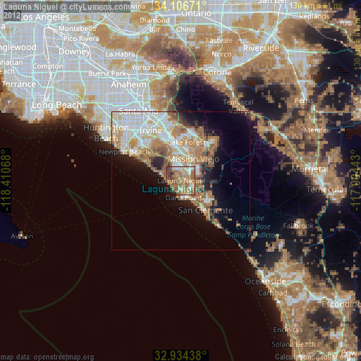
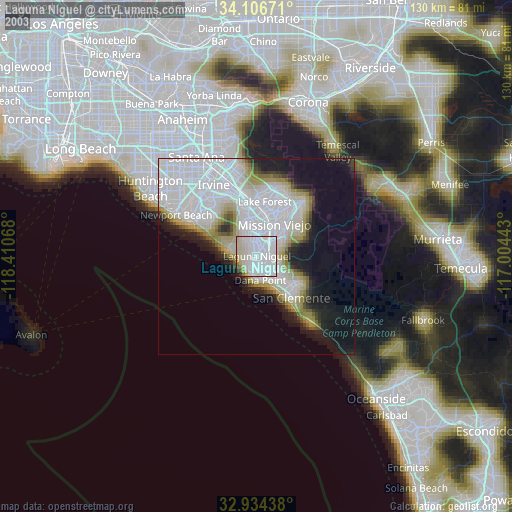
» NASA city lights 2003
» Earth at Night: Flat Maps 2012, 2016