Aliso Viejo night lights from space
Night Light of Aliso Viejo (California) from space (United States) Src. Average luminocity for 10x10km area is 70.6795% and for 50x50km: 35.372%.
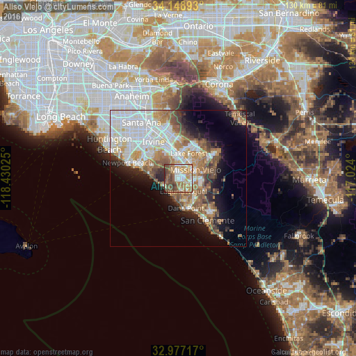
Analysis of Aliso Viejo night lights 2016
Square area 10x10 km:
 11.72%
90-99
14.47%80-89
6.04%70-79
16.48%60-69
19.05%50-59
13.19%40-49
15.38%30-39
3.11%20-29
0.55%10-19
0%0-9
0%Square area 50x50 km:
9.68%90-99
7.98%80-89
3.27%70-79
3.82%60-69
6.45%50-59
5.33%40-49
3.72%30-39
2.39%20-29
3.95%10-19
8.23%0-9
45.16%Clear (daylight) street map image can be seen on geolist.org.
Map coordinates:
34° 8' 56.1" North, 118° 25' 48.9" West
33° 33' 54.1" North, 117° 43' 37.6" West
32° 58' 37.8" North, 117° 1' 26.4" West
Some cities around Aliso Viejo sort by population:
• Mission Viejo
6.4 km =4 mi,  52°
52°
• Laguna Niguel
5.1 km =3.2 mi,  159°
159°
• San Juan Capistrano
9.2 km =5.7 mi,  139°
139°
• Laguna Hills
5.4 km =3.4 mi,  14°
14°
• Laguna Beach
5.8 km =3.6 mi,  243°
243°
• Ladera Ranch
8.5 km =5.3 mi,  85°
85°
• Laguna Woods
5 km =3.1 mi,  1°
1°
• Las Flores
9.6 km =6 mi,  74°
74°
5323163 (p: 50,195)
Sources (retrieved 2019-11-25):
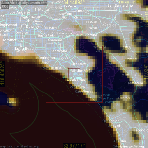
» NASA, Earths city lights 1995
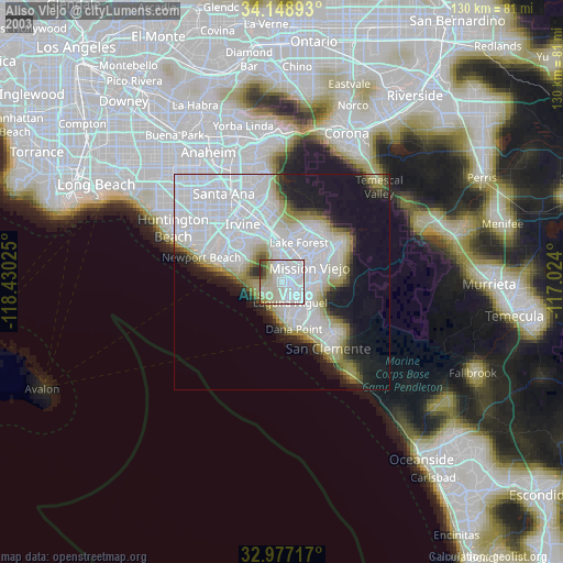
» NASA city lights 2003
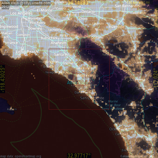
» Earth at Night: Flat Maps 2012, 2016