Kent night lights from space
Night Light of Kent (Washington) from space (United States) Src. Average luminocity for 10x10km area is 85.3884% and for 50x50km: 42.876%.
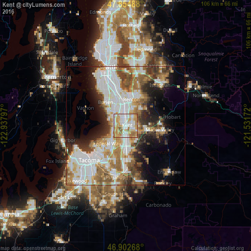

Analysis of Kent night lights 2016
Square area 10x10 km:
 21.73%
90-99
26.49%80-89
14.14%70-79
21.73%60-69
10.86%50-59
5.06%40-49
0%30-39
0%20-29
0%10-19
0%0-9
0%Square area 50x50 km:
12.32%90-99
9.78%80-89
3.94%70-79
5.21%60-69
6.39%50-59
5.67%40-49
4.33%30-39
4.21%20-29
5.84%10-19
7.84%0-9
34.47%Clear (daylight) street map image can be seen on geolist.org.
Map coordinates:
47° 51' 17.6" North, 122° 56' 16.7" West
47° 22' 51.3" North, 122° 14' 5.4" West
46° 54' 9.6" North, 121° 31' 54.2" West
Some cities around Kent sort by population:
• Federal Way
8.8 km =5.5 mi,  221°
221°
• Auburn
8.2 km =5.1 mi,  176°
176°
• Des Moines
7.1 km =4.4 mi,  288°
288°
• East Hill-Meridian
5.7 km =3.5 mi,  54°
54°
• SeaTac
8.7 km =5.4 mi,  330°
330°
• Covington
8.9 km =5.5 mi,  106°
106°
• Lea Hill
7.3 km =4.5 mi,  146°
146°
• Lakeland North
6.2 km =3.9 mi,  210°
210°
5799625 (p: 126,952)
Sources (retrieved 2019-11-25):
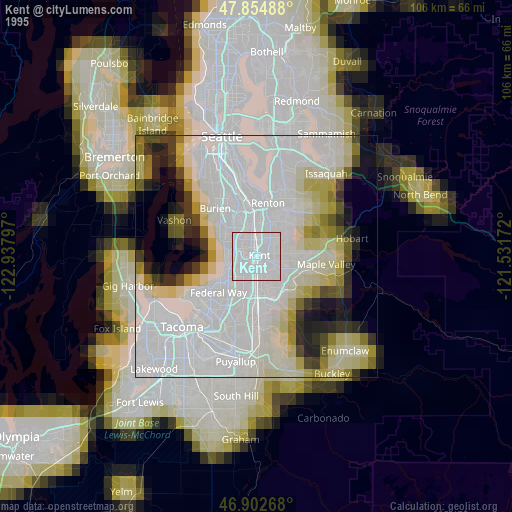
» NASA, Earths city lights 1995
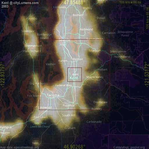
» NASA city lights 2003
» Earth at Night: Flat Maps 2012, 2016