Federal Way night lights from space
Night Light of Federal Way (Washington) from space (United States) Src. Average luminocity for 10x10km area is 75.0298% and for 50x50km: 44.5209%.
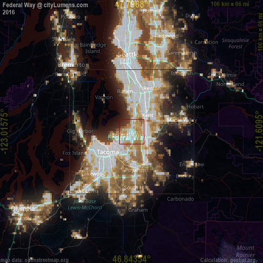

Analysis of Federal Way night lights 2016
Square area 10x10 km:
 13.39%
90-99
16.82%80-89
11.31%70-79
27.98%60-69
13.99%50-59
3.42%40-49
2.38%30-39
3.72%20-29
5.65%10-19
1.34%0-9
0%Square area 50x50 km:
11.63%90-99
9.9%80-89
4%70-79
5.4%60-69
7.05%50-59
6.97%40-49
4.76%30-39
4.5%20-29
6.98%10-19
9.87%0-9
28.94%Clear (daylight) street map image can be seen on geolist.org.
Map coordinates:
47° 47' 48.5" North, 123° 0' 56.7" West
47° 19' 20.4" North, 122° 18' 45.4" West
46° 50' 36.7" North, 121° 36' 34.2" West
Some cities around Federal Way sort by population:
• Kent
8.8 km =5.5 mi,  41°
41°
• Auburn
6.6 km =4.1 mi,  104°
104°
• Des Moines
8.9 km =5.5 mi,  354°
354°
• Lakeland North
3 km =1.9 mi,  65°
65°
• Lakeland South
5.4 km =3.4 mi,  155°
155°
• Edgewood
8.2 km =5.1 mi,  169°
169°
• Milton
8.2 km =5.1 mi,  180°
180°
• Pacific
8 km =5 mi,  143°
143°
5794245 (p: 95,171)
Sources (retrieved 2019-11-25):
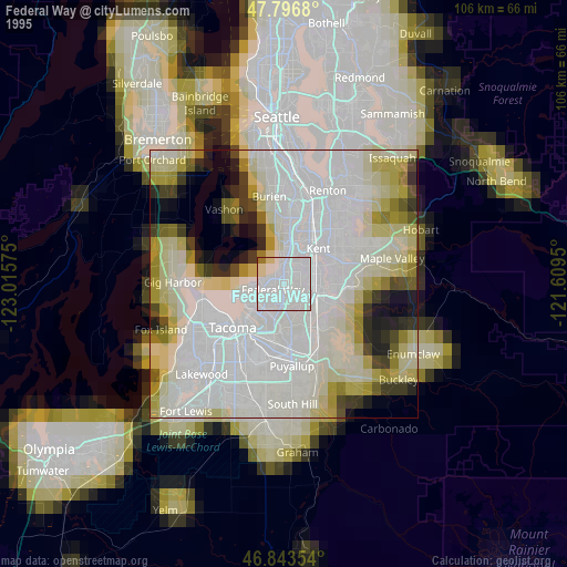
» NASA, Earths city lights 1995
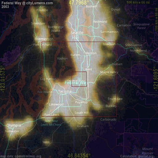
» NASA city lights 2003
» Earth at Night: Flat Maps 2012, 2016